Search the Community
Showing results for tags 'Terrain'.
Found 229 results
-
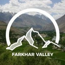
Hi, I make a terrain on arma 3 (Farkhar valley ) When i make pbo with pbo project, there is troobleshoot and error log " checking config.cpp's for land_xx..." and there are many objects error " error P3D: unknown odol format". An idea? Can you help me? Thank you Best regards
-
This started out as a test, begun around late July 2017. I wanted to see if the game engine could handle a 1.5m cell size. I decided to see it through and continue developing it. There should be several small villages once I'm finished. https://steamcommunity.com/sharedfiles/filedetails/?id=1060191411 Terrain size: 1.5km
-

Chernarus 2035 (Chernarus + Utes + More)
crazy mike posted a topic in ARMA 3 - ADDONS & MODS: COMPLETE
Steam Workshop: http://steamcommunity.com/sharedfiles/filedetails/?id=1113631358&tscn=1503026494 Chernarus 2035 is the Eastern area of the fictional country of Chernarus, known by most to just simply be Chernarus. This mod aims to be a slight re-master and overhaul to some locations of Chernarus in line with the original terrain. The terrain size has been increased from 225km2 to 419km2, a number of new islands large and small have been created off the coast of Chernarus, ranging from a Nuclear Power Plant to a large island with an airfield a some small settlements, to nearly a dozen smaller islands to fill in the gaps. More inland enhancements to locations are also underway, currently the only location which has had any noteworthy changes is Elektro with a large upper town area being added. Utes island has been added to the map aswell, bringing the total playable space up significantly, and even more locations previously barren may also be updated in the future. Thank you! Other notable features: -Overhauled Grass Configs & Textures -Beautiful Lighting, Sky, and Cloud Configs -Many structures have added interiors by Argument and myself -Utes Island + Chernarus merged -Post-Catastrophe Setting (Garbage and abandoned vehicles) -Many new additions planned for the future- 127 replies
-
- 19
-

-

-
Delete/Destroy Minaret on CUP Map
lawman_actual posted a topic in ARMA 3 - MISSION EDITING & SCRIPTING
I feel like this should have been asked and answered somewhere already but I haven't found it yet. I'm working on the Takistan CUP map and have just discovered that the minarets are indestructible. This is most unfortunate since I've just spent a while working on a script to detonante an IED inside one which I was really hoping would bring the building down. I was looking into ways of destroying and deleting objects that are already part of the terrain but haven't yet been able to get it to work with CUP buildings. Is there a way? -
Introducing my first terrain: Ergon County [WIP] Ergon County ([WIP] name) is based off a fictional region in the Rocky mountains, Canada. It has dense forests and a few villages with surrounding military bases. The map also varies greatly in elevation seeing as it is created with inspiration of the rocky mountains. Dense forests with tall trees and various locations give it a feel of a county up in the north with a vast wilderness as well as scattered villages and military installations. Features: 4km X 4km terrain making it a small but detailed terrain Detailed villages / towns scattered around the map Several military installations Completely created with Buldozer Dense forests with beautifull snow themed trees and mountains Several open areas open for possibilites such as camps, or base building Almost all buildings are enterable Planned features: Airfields (2 or 3) where there will be a mix of military airfields and civillian airfields More custom areas with great detail added to them More towns and possibly a connecting river across the map Screenshots (Bare with me, I am not the best at taking pictures) Old Castle One of the towns One of the military installations Abandoned quarry The complete album:
-

Turning off collision for terrain objects possible?
lunatic SMC-1 posted a topic in ARMA 3 - TERRAIN - (BUILDER)
So I've got a small problem with my terrain. There are a lot of bushes wich have collision. Usually that's totally fine but when there are big fields of bushes, those will block shots far too good. (making infantry within those fields nearly invulnerable) So I'd like to turn off the collision on those bushes to offer better gameplay. Is this possible at all? And if so, HOW do I do it? I haven't found any setting or option. (Of course I could rework all fields so that they just consist of a texture with those bushes added as clutter. But I wanted them to be good spots for hiding. And clutter will disappear on lowest gfx setting ingame, wich completely ruins the purpose of those dens bush-fields)- 2 replies
-
- terrain builder
- objects
- (and 6 more)
-
I've been playing Arma 3 fine but recently my game started having these Terrain issues. I don't really know what they are or how to fix it and i tried to look for it somewhere else but couldn't find someone with the same problem. https://gyazo.com/1d525042839229882e872bc5b383818f - A picture of the issue. Please help I do not know how to fix this.
-
Dear all, Until this day, I've added polygons and shapefiles directly in Terrain Builder. This is ok for smaller terrains, but definitely not for the ones I'm doing now. Now, for the past two weeks I've been trying to add OSM data to my terrains. I've followed these two main tutorials: Terrain Processor PMC Editing I appreciate the efforts, but I've tried everything I could and these simply are too incomplete to successfully finalize a map. For instance: In TB maps need to be of a power-of-two size, such as 10240. It is rather unclear how you can ensure that your satellite map is of this size. One solution is to select a square size in Terra Incognita, but then the coordinates you specify will not match exactly the ones of the map that will be downloaded (you can try this yourself, just save a square map selection from Terra Incognita as OziExplorer and then open it up in QGIS: the area will extend the coordinates you first entered). This means that if you use your reference coordinates you entered in Terra Incognita, they will be off for all of your other downloads. All the tutorials specify WSG 84 / UTM Zone 31N, however all of the downloads from Terrra Incognita, OSM and even OpenTopography are in WSG 84. It is far from clear when these conversions should happen, and how. Most of the times I end up having portions of data in completely different areas of QGIS even if they all are in the same Coordinate System, after following instructions. Once you export a reference height-map from Terrain Builder for a 10,240 sized terrain, the coordinates will extend from 200,000 - 210,240E and from 0 - 10,240N. All the tutorial specify to move the roads & other OSM data by switching the WSG to Zone 31N, but the scale is always off. I was able to move the elements but then they covered a tiny little portion of the destination area. When should the scaling happen? One of my areas is in Afghanistan, which is in UTM Zone 42N. Tutorials say you should use this when importing the data, but they also state that in Terrain Builder it MUST be UTM Zone 31N. This is so confusing and it doesn't help understanding what to do. This is such a pity. My best option is still to go ahead and draw 1,000+ roads and 700 polygons for forest areas BY HAND. Doesn't sound like a "best option". Hence: has some kind soul posted somewhere a precise how-to example workflow with screenshots or videos, so that it can be really clear what it must be done, in what order, etc? I'm pretty familiar with terrain building (latest map Kastellorizo is currently #1 on Steam's workshop), would love to contribute more and help back; however, I'd love to have someone finally dissolve clearly what is a good WORKFLOW to make all of this happen seamlessly. ....Pretty please? :) _SCAR.
-
========================= KASTELLORIZO - ISLAND ========================= I’m pleased to announce that the island of Kastellorizo has been released today in beta. Kastellorizo (Καστελλοριζο) is a beautiful island in Greece of 11.98 km2. It is the easternmost Greek island and is situated in the Eastern Mediterranean. This is a self-contained mod that has no dependencies, which can be downloaded from: the Steam Workshop SHOWREEL IMAGES GUILTY PARTIES 2RGT SCAR 2RGT EagleOne 2RGT Rigel 2RGT Tapparella Comments and feedback welcome. _SCAR
-
I am quite new to modding arma, and modding for arma as well. That said, forgive me if I am being dumb or forgot to look for something. I seem to be at a problem. I worked on making a realistic terrain for around 3 days. Then, i booted up Terrain Processor and realized that there was no "import .raw" or "import .png". The only file extension I found was .dem. I am not trying to use terrain data from the earth. I would like to find a way to either convert a .png or .raw to a .dem, or figure out how to import a .raw or .png to the terrain processor Thank you for your time
-
I am trying out the Terrain Processor Tutorial but I have problems to succeed the Heightmap step. I downloaded the corresponding heightmap "n50_e014_1arc_v3.dt2" from http://earthexplorer.usgs.gov/. Then I reprojected it with QGIS (Raster > Projections > Warp (Reproject)) to "tut3.tif". And later I converted it to ASC (Raster > Conversion > Translate (Convert Format)) to "tut3.asc". Now I am trying to process the heigtmap with the Terrain Processor and the "HeightmapGeneration.tpp" project. I have waited over an hour but the Terrain Processor did not finish the task. So I really need help with this. How can I process a heightmap from earthexplorer with QGIS (or an other tool) to Arma 3? I uploaded all files to Dropbox. Thank you for your help.
-
Chernarus Redux In the post-Soviet country of Chernarus. Several years has passed since the insurgency conflict and viral outbreak. The russian oriented country is now desolate and overgrown. The few that remain and inhabit the surrounding cities have chosen to bare arms and scavenge the land for supplies which is difficult to come by. Some may chose to believe Chernarus is hopeless, however there is a growing movement of survivors trying to take back the very cities they lost 26 years ago. What Is It? Chernarus Redux has been a on and off project for a few months now, The goal is to bring the Arma 2 Chernarus up to Arma 3 Standards, with the inclusion of making it a more of a apocalyptic feel. So it can be used in the way a lot of Arma 3 mods are trying to achieve. We are trying to strive towards adding that extra bit of detail that has always been missing from this beloved map. We also have a modeller which has made amazing progress on opening up a lot more buildings. Download from Steam Development Road Map Public Defect Tracker Social & Communications Discord Youtube Channel Twitter Requirements - CUP Core If you have any ideas or any suggestions please post them in any platform you like. Will like to say Thank You for Bohemia giving us the go ahead for the project. Where the data came from: Arma Licensed Data Pack Arma 2 Sample Models
- 269 replies
-
- 30
-

-
I download a map from armaholic and convert it to .pew. In Visitor 3 and Buldozer i have a nice work. All objects and etc. are a good worked in Buldozer and Visitor. But after Export .wrp and Bynarize i have some ingame problems. There are no roads on the map, and neither roads nor objects are displayed on the "minimap" itself. Only the names of cities from the config. Tried a lot of options with the replacement of the roads themselves. I tried to add MLM for road models (although they worked in the Bulldozer before). Very much I ask to help or assist me and I ask a pardon for bad English. Thank you
-
- binarize
- map terrain
- (and 4 more)
-
All, I’m pleased to announce that we’re currently working on a new island for Arma 3, Kastellorizo. Kastellorizo (Καστελλοριζο) is a beautiful island in Greece of 11.98 km2. It is the easternmost Greek island and is situated in the Eastern Mediterranean. If you have seen the movie Mediterraneo of G. Salvatores you might already be in love with it. Here is the in-game satellite view: [Link to Google Maps] We have chosen it for its relatively small size, for its beauty, and because there are interesting panoramas, especially from the top view points (250 meters ~270 yards above the sea level). Its main and only city has beautiful and typical colored houses, and 2 sea ports. The terrain also has 1 airport, 2 military bases, 2 main archeological sites, 3 mountain steps (we think that we have built something very unique in Arma, check the video below!), 1 power plant, 1 gas station, 1 bridge radio, 1 cemetery, 1 mosque with a minaret, 1 private villa on a small island, many farms, churches, and a variety of ruins all around the place. We’ve tried to keep the island spirit intact, by immersing ourselves in all the videos, photos and tourist maps we have been able to find online and reproducing as much as we could. Don’t expect a 100% faithful representation though, as we have taken some liberties partly due to limitations from the Arma engine, but also to improve terrain playability. We think that this terrain will be mainly interesting for infiltration, VIP exfils, sabotage, and CQB scenarios. That being said, we are looking forward to see what scenarios makers will do with it :) Kastellorizo will be a standalone terrain (no external dependencies such as CUP or DLC content). Some helper functions will be there, for instance to turn on/off lights in the military bases, or open the gates that are already included in the map. This is a joint effort done in collaboration with members of the 2RGT clan: _SCAR EagleOne Mister-Pizza Tapparella BTW check us here if you are looking for an Italian clan: http://www.secondoreggimento.it/ Enough with the talk :) Here are some videos for you. A quick tour of the main port by boat: Walking the panoramic stairs up to St. George Of The Mountain: St. George Of The Mountain: Paleokastro by dawn(archeological site): Cruising around: A landing at the airport: Comments and feedback always welcome! _SCAR
- 11 replies
-
- 19
-

-

-
- kastellorizo
- terrain
-
(and 1 more)
Tagged with:
-
Mapname: Orcas Island Status: ( 20.05.2017 ) Version: 0.1.4 / pre Alpha Mapsize: 600km² Largest Island: 148km² Current Object Count: ~ 70.000 Gridsize: 4096 Cellsize: 6 Mapsize: ~ 600km² Satelite Image: 24576x24576 Pixel Hi Community. After 2 years from my last release, and stopping some other works, i am happy to show you my current new project. I work from my home office, and can spend between 4 - 6 hours per day, for developing this terrain. If u want to support me, or if you have any questions about terrain creation, visit me on discord, facebook, youtube or patreon.
-

terrain [WIP] Terrain Elba_Summer Island - Vanilla Arma
W4lly63 posted a topic in ARMA 3 - ADDONS & MODS: DISCUSSION
Hi, I'm working on a new map, Elba Island ... that's will be a realistic reproduction of this island located in Italy - Tyrrhenian Sea. A while ago, when I was young :-))) , I traveled all the streets of this island on a bike and so I decided to reproduce it based on my knowledge of the place and google map3d for the exact location of objects (houses, trees, walls ... .) For now I've finished the most boring part (leveling roads etc ..) and a small part of forest and houses. The style of houses and buildings is the same as altis and also the type of vegetation but Elba is much more vegetation, so we say similar to cherno in percentage .... I want to make a map that doesnt need cups or other addons .... a Vanilla Arma map ... As for the completion I will update in this thread but I assume it will not be before the end of 2017. Elba Buildings Style Map Size 32768x32768 Grid 8192 Cell 4 m Sat Image 32768px Resolution 1m/px Smooth Roads/Terrain [complete 98%] Objects Insertion [complete 5%] Some Screens but for now nothing of striking cuz just started :-)) The goal is to create an "abandoned" style like esseker style or similar maps :-))- 38 replies
-
- 28
-

-
Hello guys, I'm new to this area and would like to know more about how to create my own island for ARMA 3 on the basis of real data. Recently I've come across a Russian-language article in STEAM workshop which described the process of creating an island on Google Maps. I used Google translate to understand the article but it was still quite complicated and a part of the article was not clear to me. Perhaps, some knowledgeable people would find it easier to understand this. I would be very grateful if any of you agree to write a similar lesson! Here is the link to the lesson (rus): https://arma-play.ru/kak-sozdat-kartu-po-google-maps.html And here is an example of the result in the steam workshop: http://steamcommunity.com/sharedfiles/filedetails/?id=844987995&searchtext=
-
So i just updated pboproject to version 2.11.6.24. And now everytime i try to crunch my terrain it stops with the following message(no warning label): <searching for cfgworlds.nameofwrp> there is class tiad_greece.wrp in cfgworlds Now i mention the update because it didnt have a problem before the update. So my question is did anything change in regards to the wrp setup in the config,cpp or is this a pboproject bug? Thanks for the help.
-
BARIGA EDIT: 1.4 out: - repacked content for better filesize - fixed objects not showing on ingame map - minor changes to placement of some trees (wich were ranging too far into roads) (older version also included:) - Replaced bulletproof bushes with custom made (non bulletproof) bushes. - Added signature and bikey steam Workshop: https://steamcommunity.com/sharedfiles/filedetails/?id=886316372&searchtext=bariga Armaholic download: withSIX download: ArmA3.de Mirror also avialable (still 1.2): DESCRIPTION: This terrain is completely fictional and not based on any realworld location. I tried to acchieve a look that differs from other terrains, as it is always nice to have some variation. Background: The area of Bariga had to be evacuated because of an incident in a research facility nearby. Nobody ever returned and the evidence of the escape in a hurry still can be found all arround the settlements. ----------------------------------------------------------------------------------------------------------- some specs: size: 25 km² about 300000 objects (mostly plants though ;-) ) custom terrain-textures ----------------------------------------------------------------------------------------------------------- This is my first terrain ever, so please be dulgent ;-) SCREENSHOTS: And as requested... SATELLITE IMAGE
- 28 replies
-
- 16
-

-
Vortorsk Rebuild https://imgur.com/a/ZG9KTkx Welcome and thank you for reading my topic. I am presenting here an early look / development updates of my upcoming terrain, Vortorsk. This is my first terrain project and hope to hone my skills as I develop the terrain further. This terrain is a multi-island eastern European theme post-apocalypse map, the nature of the apocalypse is up to mission makers, although the map WILL have a subtle storyline coming with it. This map is fictional and loosely based off the shape of my home state in the U.S. The island is located in the Sea of Okhotsk, and has been abandoned for many years since the fall of the Soviet Union, after losing the support of the USSR the micro-nation Vortorsk fell into disarray, it began slowly bleeding its population. 6 months later in June 1992, an event occurred crippling the nation and killing off a majority of the remaining population. Many attempted to flee the island by boat or plane, but most civilians were forced to stay on the island, eventually succumbing to something or another... The major cities on the island have since fallen into decay and have begun to fall apart, nature is slowly taking back the cities but due to the harsh climate in the Sea of Okhotsk, it has been a slow process. Many civilians had fled underground in one of the many locations below ground level on the island, making for good hiding spots and terrible dead ends. The military of Vortorsk was not prepared for the events of 1992 and fell apart within months, leaving scattered supplies across the island from lost patrols, deserters, and worse. With the current state of the island, not much is stopping anybody from getting to the island, but it has been all but erased from maps and made difficult to find, be warned however as only rumors circulate as to what really happened, seeing it firsthand may give you a clear picture of what happened, but it may also give you a very clear fate. Paramilitary forces have also been said to operate off the island as it is essentially lawless there and there are almost no living inhabitants on the island, or atleast, normal inhabitants. There have been some incursions onto the island ordered by the Russian Military but all of the expeditions ended horribly, thus the island was quarantined and forgotten. Some however remember, some attempt to find the island, fewer actually do, and so far, none have returned. Island Specs: Size: 20480x20480 or 419km2 Layout: 3 Major Islands, 10 Minor Islands (POI count TBA) Location: Eastern European Island Nation Season: Fall (Possible seasonal versions in the far future) Setting: Post-Apocalypse abandoned island Current Object Count: 381462
- 101 replies
-
- 28
-

-

[Terrain] Fort Jackson Training Grounds - Full Release v1.0
Drifter posted a topic in ARMA 3 - ADDONS & MODS: COMPLETE
Fort Jackson, South Carolina I have finally got my terrain builder working! I can finally continue my progress on my terrains! About this project: This terrain is based on Fort Jackson training grounds. This terrain will be a bit off from real world as it is intended and built for ArmA units and people looking for a training ground with ranges that are built according to real satellite imagery. The buildings and compounds will be different and changed, roads, foliage and geographical features will be as accurate as I can get them. There are a LOT of empty areas and ranges as you may notice when exploring, this is done on purpose for individuals and units to build their own training areas. This terrain will be modified and not resemble the real world terrain 100% and is not meant to look pretty, it is purely made for the unit I am currently in! This terrain is intended for individuals or groups to use as a training ground. Required Addons: None Release State: v1.1 Features: Main spawn area. Accurate tree lines. Multiple ranges (Both built and empty for custom ranges). Partially built MOUT area (Partially built on purpose for custom MOUT layouts). Airport. EOD area. Ordnance and Heavy Weapons range (Mortars, vehicles, static weapons, etc). Fort Jackson Photo Gallery (NOTE: The images in the gallery are from when this terrain was Work in Progress): Download V1.1: https://drive.google.com/file/d/0BwO9rIv0F5O4clRjQUxzVUpJamM/view?usp=sharing Please report back any issues about this terrain, thank you. -

[WIP] Russian Fjords Terrain (фьорд) + Screenshots
l4z0rr0b0tz posted a topic in ARMA 3 - ADDONS & MODS: DISCUSSION
Happy Saturday! I would like to share some pictures of a terrain I've been working on for the last few months. I am planning on releasing it either on Steam or Armaholic very soon! I am using it as a testing ground for some custom winter-themed .p3d objects (which I am new at making). This is my first terrain and my first mod, and if I were to start over again I'd do a lot of things differently, but I want to publish this either way because I think there needs to be more arctic themed-maps. Right now I am more interested in starting a new project than I am developing this one much further, so I would potentially be open to sharing the source files with someone if they wanted to further develop this. Russian Fjords is a top-secret government military zone, where high tech weapons, vehicles, and equipment are developed and manufactured. It is centered around a deepwater bay in the arctic ocean, and there is only one well-guarded road in or out. The terrain design is somewhat experimental, with some underground tunnels and a high resolution heightmap. The map could be used for sabotage, espionage, intelligence gathering, or even some kind of James Bond themed machina. Honestly you can use it for whatever you want, it's just not really designed to be used for traditional mission based gameplay, it's more meant as a decent-looking, immersive, cinematic landscape than anything. Features: - 8x8km Arctic Map with 6 custom ground materials (Thank you to Dmitry Chugai of texturelib.com for the ground textures) -Heightmap, Attributes, and Sat map created using L3DT Pro and MS Paint - Unique modeled and textured .p3d objects (Snowy fir trees, space rocket) using 3ds MAX and GIMP - 10,000+ hand-placed objects - A long road which goes all the way around the map and took foreveeeeer to level out - An industrial port, and a military airbase, and several military research areas - Several road tunnels - No mod dependencies, should be compatible with any other mods Known issues: -The stock arma 3 rocks do not look "Great" since they are not covered with snow. When I started this map I did not know how to do custom objects at all. -I have not tested this map with AI and don't know how they'd behave, especially in caves/on ledges -The caves are questionable and I wouldn't recommend making a map with them the way I did. The rocks do not occlude light as you'd hope. - Because the heightmap resolution is 4m, some areas are sharp and bumpy, and depending on your terrain LOD setting, distant terrain can look kind of bad. On my next terrain I'll be using at least an lower heighmap resolution to prevent this, but I am not planning on going thru the entire map and fixing every bump at this point - The ocean goes from shore to super deep very quickly. I do not plan on fixing this - I have messed with the rain settings in config to try to make the rain look more like snow but maybe some people will think it looks funky now. I think built in snow support in Arma 3 would be sick, but for now you can at least use some snow scripts (http://www.armaholic.com/page.php?id=29156 is one snow script, but the PPEffect color correction can make it very bright and hard to see anything during the day. tweak the script as necessary) - There may be issues with my custom objects that I'm not aware of, I'm very new to making objects Planned features: -Creating snow-covered clutter, and objects such as bushes and rocks, maybe icebergs, improving the look and functionality of objects -Adding some more docks and smaller decoration-type objects such as fences -Possibly Adding some runway overlays -Properly naming and labeling all locations on the map in Russian/Cyrillic -Possibly moving the zone of the map north so that the days are shorter -Continually improving my understanding of how to write a proper config (snow particle effects for driving in the snow is one thing I have yet to master) Please let me know if anyone would be interested in working with me on this or a future projcet! I am open to working with others! Thank you! -
Krokom is a part of northern Sweden brought to Arma 3. Most of the area exists in reality but has been heavily modified and fictionalized to some extents to meet quality. More screenshots can be found here. Krokom currently features: Size: 8x8 km. Season: Late summer. Terrain: Wetlands, lakes, mires, rivers, fir forests, deforested areas, the mountain Ansätten, small villages, industries and farms, military airfield. Objects: Custom trees and vegetation, roads, textures along with some modified vanilla objects. Current mod dependencies are @sfp_objects and @CUP_TERRAINS_CORE. Release is scheduled for January 2018 - this, all of it's features, dependencies and other details, is obviously subject to change. I have stopped working on this project and the project's ownership has been moved to SFP. For more details, read my post on the third page.
- 72 replies
-
- 71
-

-
Most community released terrains are tiny, bis made Stratis is tiny 8km where Altis is decent size 30km, so your Jets DLC options are very limited. There are no "flyboys" terrains as good old Bushlurker (RIP, brother) used to call them. But jet pilots don't need to worry because PMC comes to the rescue! Jets DLC PMC Real World Data Terrains for ArmA 3. Real world terrain data is: SRTM heightmap, maps.google.com satellite texture and OpenStreetMap.org roads. This is realistic 1:1 scale terrains for their real life locations, nothing has been scaled down or faked. If not stated otherwise all terrains are 143km x 143km in size with 71,680 x 71,680 resolution satellite texture which is 2 meters / pixel. There are no (or very few) objects placed! 2020-11-16 note; there are millions of objects in vegetation depending on specific terrain. Plan is to develop these terrains further, for example populate them with objects (trees, rocks, town/city buildings etc), but no promises. Releases (not up to date as of 2022-04-27T08:39:00Z, see PMC Tactical Terrains page for latest updates): PMC Iraq, Al Kut v0.1 PMC Iraq, Baghdad v0.1 PMC Iraq, Basrah v0.1 PMC Iraq, Erbil v0.1 (erbil currently conflicts with afghanistan ghazni and iraq baghdad, so you need to run them separately. this has been fixed for next update). PMC Iraq, Hillah (40km x 40km) v0.1 PMC Iraq, Karbala (40km x 40km) v0.1 PMC Iraq, Kirkuk v0.1 PMC Iraq, Mosul (81km x 81km) v0.1 PMC Iraq, Najaf (81km x 81km) v0.1 PMC Iraq, Nasiriyah v0.1 PMC Iraq, Ramadi (40km x 40km) v0.1 PMC Iraq, Rutba v0.1 PMC Iraq, Samawah (81km x 81km) v0.1 PMC Iraq, Sulaymaniyah v0.1 PMC Iraq, Tikrit v0.1 PMC Afghanistan, Ghazni v0.1 (ghazni requires CUP Terrains Core because it uses takistani village buildings and vegetation). PMC Afghanistan, Jalalabad (81km x 81km, 81920 resolution satellite) v0.2 PMC Afghanistan, Kabul v0.1 PMC Afghanistan, Kandahar v0.1 PMC Afghanistan, Kunduz v0.1 PMC Afghanistan, Lashkar Gah v0.1 PMC Afghanistan, Mazari Sharif v0.1 PMC Syria, Al Hasakhah v0.1 PMC Syria, Al Mayadin v0.1 PMC Syria, Aleppo v0.1 PMC Syria, Ar Raqqah v0.1 PMC Syria, Damascus v0.1 PMC Syria, Homs v0.1 PMC Somalia, Baidoa v0.1 PMC Somalia, Kismaayo v0.1 PMC Vietnam, Da Nang v0.1 PMC Vietnam, Dong Hoi v0.1 PMC Vietnam, Hanoi v0.1 PMC Vietnam, Pleiku v0.1 PMC Vietnam, Saigon v0.1 PMC Libya, Ajdabiya v0.1 PMC Libya, Bani Walid (81km x 81km) v0.1 PMC Libya, Bin Jawad v0.1 PMC Libya, Misrata v0.1 PMC Libya, Msallata v0.1 PMC Libya, Nafusa v0.1 PMC Libya, Ras Ajdir v0.1 PMC Libya, Sabha v0.1 PMC Vietnam, Vinh v0.1 PMC Libya, Sirte v0.1 PMC Libya, Tripoli v0.1 PMC Libya, Wazzin (81km x 81km, 81920 resolution satellite) v0.1 PMC Afghanistan, Asadabad (81km x 81km, 81920 resolution satellite) v0.1 PMC Libya, Benghazi (143,360 x 143,360 resolution satellite) v0.1 PMC Ukraine, Donetsk (81km x 81km, 40960 resolution satellite) v0.1 PMC Ukraine, Luhansk (81km x 81km, 40960 resolution satellite) v0.1 PMC Ukraine, Mariupol (81km x 81km, 40960 resolution satellite) v0.1 PMC Pakistan, Abbottabad (81km x 81km, 40960 resolution satellite) v0.1 PMC Balkans, Belgrade v0.1 PMC Balkans, Kosovo v0.1 PMC Balkans, Montenegro v0.1 PMC Balkans, Vojvodina v0.1 Satellite screenshots see PMC Tactical ArmA 3 Terrain page and download from PMC Tactical ArmA 3 Downloads.
- 247 replies
-
- 26
-

-
Hi map/terrain/environment/world… makers, this is, after working at BI/BISim for almost 10 years, my first topic created here at BI forums. In my defense, I’m mostly active in Arma 3 Maps Terrains Skype’s group, but the topic I want to share with you deserves to be discuss here(skype has short memory and is not as comfortable as forums, for such kind of discussion). The Topic? It’s of course the bLandscapeTools(bLT), an addon for Blender I’ve been already working on for the last 8 years. The main reason I started this addon was: already knew Blender wanted to improve my python scripting skills, as I like to automate or at least speed up processes many handy world creation features were not available back then, are not available now and will never be implemented in BI/BISim world creation tools Necessary to note that I never intended to write a tool which would take over the world BI/BISim tools, but rather try to fill gaps(small/large) in terrain development. Blender is a 3D modeling tool(and much more), but you can’t expect fancy features which can handle big chunks of terrains with millions of objects on it, it has its own bottlenecks and limits, but even back then I could see, that the advantage of having possibility to import terrain mesh and its textures to Blender and start placing environment content much more easier way(comparing to Buldozer) or even modeling content over a terrain is a feature that will never come into Terrain Builder/Buldozer. By sticking together Blender’s default features like sculpting, painting + powerfull API I was basically able to add many time consuming and “Visitor4/TerrainBuilder hard to get implemented” features into Blender. Let’s stop talking for now… check out my talk at BlenderConference2016 about the Blender Terrain Tools(Edit: just currently I changed the name to bLandscapeTools) so you guys can make an image of what I’ve been working on. There are some features which will be really hard(almost impossible) to release because they are closely bound to BI dev content like raw(non-binarized) P3Ds, but on the positive note bLT has some handy features not even mentioned in the video(like quality assurance tools) Why now? After the conference I got contacted by individuals and even teams, asking me where they can download the addon as they would like to have their hands on it and give it a try. So I decided to start releasing the tool bits by bits to people so they, hopefully, can have a fun time play around with bLT. Also, the fact that this year(2017) it's going to be 10 years at BI/BISim or in other words working with the RVengine, as well as, Paul Pelosi(bushlurker) suddenly passing away, made me to do this decision and release the tool. It’s also going to be a challenge and something new to me, releasing my tool to other people, it needs a change of thinking about the tool, fix some parts of the pipeline..etc. and that may take some time. How? There’s plenty of how in the front of me. I need to figure out a way how to share the tool with you guys. Github, Blender market I have in my mind right now. As mentioned already, there are features hard to release(raw P3Ds). In this case I’ll have to ask someone here in BI, if company would be willing to release let’s say at least last LODs of assets so they could be imported into Blender and used within bLT. I use Blender for over 10 years, so I’m pretty comfortable with its workflow, but this doesn’t have to apply to a newcomer. Therefore, I’ll have to take some steps to make bLT even more user friendly than it is right now. I plan to make quite some tutorials how to use Blender and bLT to user’s satisfaction. Currently, Blender development is at the stage where quite a big major changes are being implemented and to be released with Blender 2.8. There’s going to be plenty of great new features such Viewport update(supporting PBR shaders), new Layers, Workflow system and much more. This means that I’ll have to re-think some of the bLT features to support all these new improvements once they’re released. Therefore I don’t want to do any major touches into what exists in bLT now. I hope that the improvements done for 2.8 will take bLT a few steps further again, as it already happened with the transition from Blender 2.4 to 2.5+. So once again, I’d like to ask you to have a look at my talk, if you have any questions please don’t hesitate to ask. It will help me to move on with releasing the tool as well as to know how the features should be done to help you create a map for any RV engine related project. When? Release of the '0-th' or 'Introduction' version is planned on the end of summer holidays. Progress will be tracked here. Subscribe to my personal youtube's channel here. Tools Github's here. Twitter Cheers, Miro
- 44 replies
-
- 31
-

