Search the Community
Showing results for tags 'map', 'mountains' or 'norway'.
Found 153 results
-
Hi, I've been trying to make gameplay more realistic recently and map markers have been making this hard since anybody in the channel that you select can see the markers. I have restricted most channels in the description.ext and left group channel as it is probably the best option for this but that still means that everybody in the group that you are in can see the markers, even if they die and are half way across the map. I can't seem to find a way to add direct to the list of available channels. I would like to be able to place map markers in direct channel or in a similar way to the pointing mechanic so only people near me could see the markers placed. I have been googling and searching the forums for a few hours now with no luck, any help would be appriciated. Thank you in advance.
-
Hey guys, each day you want to learn something more. I think its time to go further into Dialog editing. What I want to do is, I want to have a simple Dialog where in the middle will be a map (which you can move and everything). On this map I want to have clickable/selectable "Marker". When the marker is selected, you then press on a button and will be teleported to that position. So its basically a MHQ script. What I also want to do is, having the teleport option only work when the vehicle is alive and not moving. My biggest problem right now is though, that I have no clue how to get the map and the selectable marker. Anybody have an Idea how I could do that? Thanks so far. If you have any further questions, just ask! Many greetings Moony
-
Introducing my first terrain: Ergon County [WIP] Ergon County ([WIP] name) is based off a fictional region in the Rocky mountains, Canada. It has dense forests and a few villages with surrounding military bases. The map also varies greatly in elevation seeing as it is created with inspiration of the rocky mountains. Dense forests with tall trees and various locations give it a feel of a county up in the north with a vast wilderness as well as scattered villages and military installations. Features: 4km X 4km terrain making it a small but detailed terrain Detailed villages / towns scattered around the map Several military installations Completely created with Buldozer Dense forests with beautifull snow themed trees and mountains Several open areas open for possibilites such as camps, or base building Almost all buildings are enterable Planned features: Airfields (2 or 3) where there will be a mix of military airfields and civillian airfields More custom areas with great detail added to them More towns and possibly a connecting river across the map Screenshots (Bare with me, I am not the best at taking pictures) Old Castle One of the towns One of the military installations Abandoned quarry The complete album:
-
hi all, i'm actually develloping a terrain for arma 3 and my ground textures are like this: https://prnt.sc/h3vqcq , how to fix this please ? thanks all :)
-
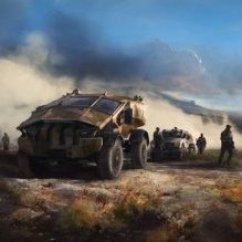
Hey. Wanted to show-case the new map Kobbvatn for Arma 3, made by Xindrum and my good friend FargeBlind. We have been working on this map of our home location in Norway, Kobbvatn / Mørsvik to Arma 3 for quite some time now, and we felt that it's time to show what we have done so far. There remains a lot of work until the map is complete, but we will launch it to the public when we feel it's playable. Kobbvatn - New Arma 3 Map Trailer We hope you are looking forward to getting your hands on the map because we can hardly wait to finish it. Enjoy.
- 13 replies
-
- 19
-

-
So I've been struggling for a long time with this problem mentioned in the title. I have made several maps in the past year and followed the same Atlas guide throughout all of them. Not once has the clutter shown up. I'm getting really frustrated because there doesn't seem to be a universal fix for this problem, and it seems like everybody's error is unique. This my first time posting and have no idea how things work around here so please be gentle. Please excuse my English, it's my second language. cfgSurfaces class CfgSurfaces { class Default {}; class del_deathland_dry_grass_Surface : Default { files = "del_deathland_dry_grass_*"; rough = 0.08; maxSpeedCoef = 0.9; dust = 0.75; soundEnviron = "drygrass"; character = "del_deathland_dry_grass_Character"; soundHit = "soft_ground"; lucidity = 2; grassCover = 0.99; }; class del_deathland_soil_Surface : Default { files = "del_deathland_soil_*"; rough = 0.09; maxSpeedCoef = 0.9; dust = 0.5; soundEnviron = "dirt"; character = "Empty"; soundHit = "hard_ground"; lucidity = 1; grassCover = 0.0; }; class del_deathland_Concrete_Surface : Default { files = "del_deathland_Concrete_*"; rough = 0.09; maxSpeedCoef = 0.9; dust = 0.1; soundEnviron = "dirt"; character = "Empty"; soundHit = "hard_ground"; lucidity = 1; grassCover = 0.0; }; }; class CfgSurfaceCharacters { class del_deathland_dry_grass_Character { probability[] = {0.21,0.35,0.21,0.09,0.06,0.02}; names[] = {"del_deathland_GrassDryGroup","del_deathland_GrassDryMediumgroup","del_deathland_WeedBrownTallGroup","del_deathland_WeedGreenTall","del_deathland_ThistleYellowShrub","del_deathland_PlantMullein"}; }; class del_deathland_Soil_Character { probability[] = {0.0,0.0,0.0,0.0,0.0}; names[] = {"del_deathland_BigFallenBranches_pine","del_deathland_BigFallenBranches_pine02","del_deathland_BigFallenBranches_pine03","del_deathland_GrassDryGroup","del_deathland_GrassGreenGroup"}; }; class del_deathland_Concrete_Character { probability[] = {0.0,0.00}; names[] = {"del_deathland_GrassGreenGroup","del_deathland_FlowerLowYellow2"}; }; }; cfgClutter class Clutter { class del_deathland_GrassGreenGroup: DefaultClutter { model = "A3\plants_f\Clutter\c_StrGrassGreen_group.p3d"; affectedByWind = 0.6; swLighting = "true"; scaleMin = 0.7; scaleMax = 1.0; }; class del_deathland_GrassDry: DefaultClutter { model = "A3\plants_f\Clutter\c_StrGrassDry.p3d"; affectedByWind = 0.5; swLighting = "true"; scaleMin = 0.8; scaleMax = 1.2; }; class del_deathland_GrassDryGroup: DefaultClutter { model = "A3\plants_f\Clutter\c_StrGrassDry_group.p3d"; affectedByWind = 0.65; swLighting = "true"; scaleMin = 0.65; scaleMax = 1.0; }; class del_deathland_GrassDryMediumGroup: DefaultClutter { model = "A3\plants_f\Clutter\c_StrGrassDryMedium_group.p3d"; affectedByWind = 0.7; swLighting = "true"; scaleMin = 0.8; scaleMax = 1.0; }; class del_deathland_WeedBrownTallGroup: DefaultClutter { model = "A3\plants_f\Clutter\c_StrWeedBrownTall_group.p3d"; affectedByWind = 0.3; swLighting = "true"; scaleMin = 0.9; scaleMax = 1.25; }; class del_deathland_WeedGreenTall: DefaultClutter { model = "A3\plants_f\Clutter\c_StrWeedGreenTall.p3d"; affectedByWind = 0.3; swLighting = "true"; scaleMin = 0.8; scaleMax = 1.2; }; class del_deathland_PlantMullein: DefaultClutter { model = "A3\plants_f\Clutter\c_StrPlantMullein.p3d"; affectedByWind = 0.35; swLighting = "true"; scaleMin = 0.7; scaleMax = 1.15; }; class del_deathland_ThistleYellowShrub: DefaultClutter { model = "A3\plants_f\Clutter\c_StrThistleYellowShrub.p3d"; affectedByWind = 0.2; swLighting = "true"; scaleMin = 0.7; scaleMax = 1.1; }; class del_deathland_ThistleThornGreen: DefaultClutter { model = "A3\plants_f\Clutter\c_Thistle_Thorn_Green.p3d"; affectedByWind = 0.3; swLighting = "false"; scaleMin = 0.3; scaleMax = 1.0; }; class del_deathland_ThistleThornGreenSmall: DefaultClutter { model = "A3\plants_f\Clutter\c_Thistle_Thorn_Green.p3d"; affectedByWind = 0.25; swLighting = "false"; scaleMin = 0.4; scaleMax = 0.7; }; class del_deathland_FlowerLowYellow2: DefaultClutter { model = "A3\plants_f\Clutter\c_Flower_Low_Yellow2.p3d"; affectedByWind = 0.4; swLighting = "true"; scaleMin = 0.6; scaleMax = 1.0; }; class del_deathland_BigFallenBranches_pine: DefaultClutter { model = "A3\Plants_F\Clutter\c_bigFallenBranches_pine.p3d"; affectedByWind = 0.0; swLighting = "false"; scaleMin = 0.3; scaleMax = 0.7; }; class del_deathland_BigFallenBranches_pine02: DefaultClutter { model = "A3\Plants_F\Clutter\c_bigFallenBranches_pine02.p3d"; affectedByWind = 0.0; swLighting = "false"; scaleMin = 0.3; scaleMax = 0.7; }; class del_deathland_BigFallenBranches_pine03: DefaultClutter { model = "A3\Plants_F\Clutter\c_bigFallenBranches_pine03.p3d"; affectedByWind = 0.0; swLighting = "false"; scaleMin = 0.3; scaleMax = 0.7; }; }; Layers class Layers { class del_deathland_dry_grass { texture = #(rgb,1,1,1)color(0.5,0.5,0.5,1,cdt); material = "DEL\del_deathland\data\del_deathland_dry_grass.rvmat"; }; class del_deathland_soil { texture = #(rgb,1,1,1)color(0.5,0.5,0.5,1,cdt); material = "DEL\del_deathland\data\del_deathland_soil.rvmat"; }; class del_deathland_Concrete { texture = #(rgb,1,1,1)color(0.5,0.5,0.5,1,cdt); material = "DEL\del_deathland\data\del_deathland_Concrete.rvmat"; }; }; class Legend { picture="DEL\del_deathland\source\mapLegend.png"; class Colors { del_deathland_dry_grass[]={{255,255,0}}; del_deathland_soil[]={{0,0,255}}; del_deathland_Concrete[]={{0,255,0}}; }; };
-
Hello, is there a digital map of Malden available or are there plans to do so? In the usual place ( ..\Arma 3\Bonus\Maps ) I still find only the maps of Stratis and Tanoa. Regards M.
-

Native Map Objects IDs changing with updates
Ulfgaar posted a topic in ARMA 3 - MISSION EDITING & SCRIPTING
Made a few vanilla missions (with DLCs) where im using object ID's to have my players interact with certain objects native to the map. My problem is that with pretty much every update where the maps have been "polished" in some way or had more objects added to them - the object ID's change and their numbers are scewed with a few digits. This ofc fucks over my mission i a severely bad way - as triggers and events depending on said object having the correct ID - suddenly wont work, as the objects ID has changed. So "blowing up" said object - wont activate the trigger, as the object now has a different ID than what the trigger is waiting for. Please fix this - as i've spent ages on making these missions which i was about to publish on steam workshop. Now however, after discovering this - it seems there is no point in publishing the missions, as they will only work up until the next time an update on the map is put into play. The big question for my sake is, why does old objects need to get new ID's when new objects are added or old ones removed? Having this happen really fucks stuff up for me as a mission creator (now that i finally figured out how to use native objects on the map as part of my missions). *sadface* //Ulfgaar -
BARIGA EDIT: 1.4 out: - repacked content for better filesize - fixed objects not showing on ingame map - minor changes to placement of some trees (wich were ranging too far into roads) (older version also included:) - Replaced bulletproof bushes with custom made (non bulletproof) bushes. - Added signature and bikey steam Workshop: https://steamcommunity.com/sharedfiles/filedetails/?id=886316372&searchtext=bariga Armaholic download: withSIX download: ArmA3.de Mirror also avialable (still 1.2): DESCRIPTION: This terrain is completely fictional and not based on any realworld location. I tried to acchieve a look that differs from other terrains, as it is always nice to have some variation. Background: The area of Bariga had to be evacuated because of an incident in a research facility nearby. Nobody ever returned and the evidence of the escape in a hurry still can be found all arround the settlements. ----------------------------------------------------------------------------------------------------------- some specs: size: 25 km² about 300000 objects (mostly plants though ;-) ) custom terrain-textures ----------------------------------------------------------------------------------------------------------- This is my first terrain ever, so please be dulgent ;-) SCREENSHOTS: And as requested... SATELLITE IMAGE
- 28 replies
-
- 16
-
-

Execute scripts when map is open
ColonelKernel posted a topic in ARMA 3 - MISSION EDITING & SCRIPTING
Hi. How can I make a script run when the map is opened? I tried this but it doesn't work: While {visibleMap} do { -

markers Creating custom map markers
TheLocalPub posted a topic in ARMA 3 - ADDONS - CONFIGS & SCRIPTING
Morning lads. So finally I've gotten time and came round to getting back on track with making custom markers. I'm currently in the process of making all Blufor, Opfor, Neutral, and Unknown markers from the "App-6aHandbook, a .pdf formated "Land component handbook" from the British Army of what all standard Nato markers are as of up till today. The photoshopping, and editing as a whole isn't a problem. My problem lays with actually getting them into Arma 3 as a mod in which people can use an place down these markers on the map either in the editor or while in-game. Any light shedded on how to do so would be great. I've seen this thread https://www.reddit.com/r/armadev/comments/1mfb0l/idiots_guide_to_making_a_custom_marker/ ,followed it, and still managed to not get anywhere. If someone could possibly just list In a step to step guide of how to do so I'd appreciate it. Cheers in advanced. -
Delete/Destroy Minaret on CUP Map
lawman_actual posted a topic in ARMA 3 - MISSION EDITING & SCRIPTING
I feel like this should have been asked and answered somewhere already but I haven't found it yet. I'm working on the Takistan CUP map and have just discovered that the minarets are indestructible. This is most unfortunate since I've just spent a while working on a script to detonante an IED inside one which I was really hoping would bring the building down. I was looking into ways of destroying and deleting objects that are already part of the terrain but haven't yet been able to get it to work with CUP buildings. Is there a way? -
Tried to do a search, and found alot of different things but could not to what i saw, find something spesificly like this. So, down to business... First of all, go to the "Debug Console" in the "Tools" menu you have in your Eden 3D editor. Type in the following: do3DENAction "ToggleMapIDs"; ..and press the "LOCAL EXEC" button. This will show you all the object IDs to all default map objects (once you have zoomed in close enough), such as radio towers, buildings, bridges, bushes, trees so on and so forth etc. etc. etc. Run it again to turn it off again. Now, I’ll type up an example on how to blow up a default radio tower on a map, and get a trigger to register this as part of your mission. Step 1: Find yourself a suitable target, in our case - a radio tower on the map by default. Step 2: Place a "Game Logic" on top or near it, from "Objects" in the "Logic Entities" selection (F5 (Systems) --> Logic Entities --> Objects --> Game Logic). Step 3: In that the "Game Logic" init field, type as an example: Target1 = (getPos this nearestObject 224112); // Target 1 is what the "Variable name" will be. // 224112 is the object ID of that specific radio tower/object, now visible on the map, from running the code at the top of this post in your debug console. Step 4: Place a trigger. In its "Condition" field, type this: !Alive Target1; ..and to check that this works, you can type this in the "On Activation" field: Hint "Tower Destroyed!"; Step 5: Now, place your charges - or whatever means you wish to destroy said tower/object - and the trigger should fire once its destroyed. I needed this, and have been through several posts to find "bits and pieces" of what i needed to make this - hoping it will help others as much as it has me :)
-
Version 1.2 Download : http://addons.ofcra.org/cirav/@Bozcaada-v12.7z ------------------------------------- Serverkey included Map size : 20km x 20km Bozcaada requires no additional addons. Google map Description : Bozcaada is an island of Turkey in the northeastern part of the Aegean Sea. Administratively, the island constitutes the Bozcaada district of Çanakkale province. With an area of 39.9 km² it is the third largest Turkish island after Imbros and Marmara. In 2011, the district had a population of 2,472. The main industries are tourism, wine production and fishing. The island has been famous for its grapes, wines and red poppies for centuries. Source Dev Team : -Cirav -Ruskoff -Arthyc -Vincent Spécial thanks : -F.S.F for Wiki Labs -Mikero for his tools -Bohemia Interactive Studio Changelog v1.2 : -Modified Map Grid -Modified entrance airfield -Remove building on road -Remove errors factory_main_part2_f.p3d Changelog v1.1 : -Modified satellite map -Modified texture map -Add karting track -Add checkpoint -Improve miltary post -Improve airfield -Improve the city of Merkez -Improve roads -Add some objects Screenshots v1.0 : http://img15.hostingpics.net/pics/349646bozcaada01.jpg http://img15.hostingpics.net/pics/773117bozcaada02.jpg http://img15.hostingpics.net/pics/886041bozcaada03.jpg http://img15.hostingpics.net/pics/558433bozcaada04.jpg http://img15.hostingpics.net/pics/577990bozcaada05.jpg http://img15.hostingpics.net/pics/774234bozcaada06.jpg Screenshots v1.1 : http://img11.hostingpics.net/pics/5027004801.jpg http://img11.hostingpics.net/pics/7542195002.jpg http://img11.hostingpics.net/pics/4412749203.jpg http://img11.hostingpics.net/pics/1922537604.jpg http://img11.hostingpics.net/pics/8417488105.jpg http://img11.hostingpics.net/pics/5420923506.jpg
-
The main font family for the text next to map markers is EtelkaNarrowMediumPro. In the most recent stable branch hotfix (build 142223), the fonts[] array for this config entry was updated, subsequently changing the visual behavior of map marker text. This bug is still present in the current development branch build. Here's a before/after picture of what map markers look like: Pre-142223 : Post-142223 : I'm assuming this was an unintentional change. If it wasn't unintentional, disregard. Here's a relevant post:
-
u think can do some plant the bomb or something but in a medium map? plant the bomb rules: 1.- one team plant the bomb and another team defend. 2.- have time limit. 3.- if u die cant respawn unless u get the air drop, or time pnenalty . like ur game have now. 4.- if all team is eliminated another team won. 5.- when some team plant the bomb, another team have 2 min to disambly. sorry my english xD. p.s. i hope find some way of give more balance to the game im new and lvl6 some times im vs lvl16 and is a crap, sorry but i feel that.
-
While I've kept the IRL island name, this terrain has been largely altered from the real island for various reasons. Besides the buildings and vegetation, I've chopped the top of the mountain off, altered a lot of roads, etc. However, it does still resemble the real place in some ways. Iwagi is a small island located in the Ehime prefecture, kinda in between Okoyama and Hiroshima. I'm planning on using assets from the Apex expansion, and so it will require having the expansion to play. Right now, it's a total of 6x6km(I guess that could possibly change if it's too small). The island itself is roughly 4x5km. I'm using a cell space(hoizontal scale) of 3m, which is slightly less than what is suggested by all the Arma terrain gurus, but I'm hoping with it being a pretty small terrain it will work out alright. While I tried to keep a lot of places true to it's IRL form, I'm mostly limited to Google streets and as such I'm completely winging most of the island. Besides that, it needs to be military friendly.. so I completely chopped the top of the mountain and I'm going to put a military base there. =] I think I started working on Iwagi in February of this year. Originally, I had started with a completely custom terrain taking bits and pieces from all over the world in Google Earth Pro and piecing them together like a Frenkenstein. After a year of killing myself I decided to jump into a smaller terrain and use a real world place. This will be my first terrain for anything. Being as small as it is, I'm not sure it will be suitable for anything milsim related(hopefully I'm wrong), I'm hoping to be able to use it for Battle Royale and/or maybe some survival mods. GOALS: - I want to keep the mod filesize as small as possible. Thus, a smaller terrain with very limited user made content/models. - I don't want to require the user to have any other community made mods loaded to play on the terrain. TO DO LIST (as of 14 Sep 2016) Finish surface mask. Finish sat map. Finish watershed erosion and reservoir objects. Place random rocks. Finish rock outcrops. Fix mixture of vegetation in forests, add rocks and fallen trees. Finish military housing area. Finish military base layout and objects. Finish airport runway, objects, and buildings. Remove all vegetation from roadways and under buildings and other objects where it's noticeable. Set water level. Check AI movements along roadways and bridges. Have all bridges placed and remove road textures from underneath. Place road intersections and transitions. Finalize clutter mixture for all surfaces, no texture issues, set color and wind variation. Fix all road gradients, remove protrusions, smooth. Place polygons for vegetation. Place back roads and trails polylines. Place secondary roads polylines. Place main highway polylines. Put together a rough sat mask for ground textures. Make a place for a large military base and housing. Sculpt a rough height map with L3DT. Put together a rough sat map to use as a guide. MEDIA IRL Location: https://goo.gl/maps/YMEwqNyjmD32 Wikipedia: https://en.wikipedia.org/wiki/Iwagi,_Ehime Photo album: http://imgur.com/a/hqQSr I don't really have many pictures or videos yet, but I'm usually streaming on Twitch when I'm working on it. Once I can get it working in Arma I'll take some snapshots and make a video. https://www.twitch.tv/cring0 https://www.youtube.com/user/cringocringo I'll be back once I have more. If you have any questions or suggestions please let me know.
- 71 replies
-
- 13
-
-
Hello and how do you do? So me and buddy are playing a quick op on Lythium and buddy is new. He asks if there are different types of maps when you hit 'M' (standard bind) like climate, topographical, road maps, etc etc. That all got me thinking. Is there a way you could implement something like this? Like a little drop down that displays "Climate map" and you can hit your default action key and it switches to a climate map (obviously would have to be done the the creator and could be stored in the mod folder). Or would it be possible to do something like traces? Have multiple layers with different markings and the sort on them. So maybe Alpha 1-1 are on layer 1 and Alpha 2-1 are on layer 2 but command has access to all of them and can plan out different marks for different squads. This would be an excellent thing to have in large scale milsim communities and could even be applicable in things such as life servers. Anyways if you have any insight leave a reply. -Uncle
-

Hide Runway Rectangle From Ingame Map?
mcgough posted a topic in ARMA 3 - MISSION EDITING & SCRIPTING
I would like to randomly spawn the USS Freedom in a different location on each server restart so the player has to find it, but the runway rectangle that is drawn on the ingame map kinda gives its location away! Does anybody know of a command to hide the rectangle which is drawn for each runway on the map? -
I download a map from armaholic and convert it to .pew. In Visitor 3 and Buldozer i have a nice work. All objects and etc. are a good worked in Buldozer and Visitor. But after Export .wrp and Bynarize i have some ingame problems. There are no roads on the map, and neither roads nor objects are displayed on the "minimap" itself. Only the names of cities from the config. Tried a lot of options with the replacement of the roads themselves. I tried to add MLM for road models (although they worked in the Bulldozer before). Very much I ask to help or assist me and I ask a pardon for bad English. Thank you
-

How to trigger player's insert marker on map
Nag's FoV posted a topic in ARMA 3 - MISSION EDITING & SCRIPTING
Hello,I want to trigger when the player insert a marker on his map in a specific area, like in the prologue mission, where you have to find AAF position (youtube link : ).If you have any link or answer which can help me, please post it!Thanks. -
I have a problem and can not go on and if I want to pack with Pboprojekt the PBO I always get this error. The source or terrain builder is closed and everything else is not used.
-
Hey, I´ve managed to get a detail map (_dt) with Super shader (.rvmat) in game. Everything is working quiet well, only that the colours are way too strong, it basically miss readys the alpha channel. Colours which should be at about 10% visibility are at almost 100%. Does anyone had experience with that problem before? Ps: For the texture, I have exported the texture_ca.png to texture_ca.paa and renamed it to texture_dt.paa. (exporting as ca works better than dt, see pictures) What the texture should look like http://fs5.directupload.net/images/170414/gn8dqwb3.png What it looks like with _ca export http://fs5.directupload.net/images/170414/x5gbdevp.png What it looks like with _dt export http://fs5.directupload.net/images/170412/ihxtojl9.png (ignore the error, solved already) Thanks for helping! MfG Benno .rvmat file
-
Hello, Is it interesting to create this maps? Or Are still satelite maps better? https://skfb.ly/6pG6t https://skfb.ly/6pvrE
-
Hi i wonder if someone can help i have been following this, when i go to open buldozer and this is the error i get https://gyazo.com/4727f2e83b96d0a5e614f4c0ab535c46