dakaodo 52 Posted October 22, 2015 Your updates and work thus far on models and terrain are amazing. Since I got into A3 5 months ago, I've fallen down a different rabbit hole (missions, scripting, and random/procedural design using ALiVE and the smallest number of mods providing the most relevant quality I can compromise on). I haven't seen it mentioned, but you are clearly well beyond my 30-second grasp of terrain and object building, so this may be small potatoes to you: I've seen a lot of threads on how the AI units can see right through a lot of ground cover vegetation, even while players cannot. One workaround mentioned was to use brush objects instead of ground clutter objects (or something like that). However, the tradeoff was system performance, IIRC. This A2-A3 terrain port http://www.armaholic.com/page.php?id=28885 indicates that it is quite possible to build brush-heavy terrain that puts the AI on equal terms as humans in terms of spotting enemy units. I know you've gone through the Armaholic objects area, b/c you found DBO ponds. I didn't even know that was a thing! All I've seen is people saying ponds are impossible, etc. And they may be at an engine level, but clearly deanosbeano has very cleverly managed to make a quite passable workaround. I hope that you can sub in things like that A2 vegetation port and possibly the various building packages (JBAD, the Australian buildings) to expedite the more workaday 60-80% of your work, with the baobab trees and other key objects as highlights that help distinguish your map. In my playing experience thus far, smaller maps with more elevation variation (no flat ground anywhere -- even town/village paths and roads have dips and bumps) and dense ambient clutter/trash provide dead zones and lots of soft/hard cover. Many of the A2 ported maps suffer from a sterile atmosphere, with buildings and roads placed too neatly on a flat plane with no objects/ground clutter/grass to hide the buildings' foundations. Also, you mentioned mission randomness. There are several mission frameworks available as script packages, most of which help to create mission functions and variety for less fuss. I'm using Zenophon's framework http://www.armaholic.com/page.php?id=26194 to give me some better control over which area markers in which to spawn units and objectives, as well as other functions. Thus far, I've only grasped about 1/3 of the FindGroundPosition function, but it's already made my missions hugely random.I've spent the better part of a month with only 3 of Zenophon's functions out of dozens. But it and BIS's own random createVehicle functions + .sqf scripts make for much more randomness than linking a player unit to a finite set of starting markers. The tradeoff is that the finite markers let one clearly specify where an object can possibly start. So if I want a vehicle to only spawn in one of 7 garage locations, I might do grouped markers. But if I don't care where on a map a crate spawns, so long as it spawns within a certain marker, I can use the BIS createVehicle function. Or if I need it to spawn in a complex area or areas (donut-shaped, multiple zones, terrain/road/object restrictions, etc.), then I use Zenophon's function. And oh god, the crate custom filler/randomization scripts, and the patrol scripts. :P Point being, I'm sure you'll find your own particular process and workflow balance between the different tools available. I personally am not yet comfortable spawning markers or vehicles with custom init fields via script, so I tend to place them outside the operations area, set alpha to 0 or disable simulation/damage, then trigger conditions (in triggers or scripts) to relocate then activate them. This is a terrible kludge that I may one day outgrow. :P Share this post Link to post Share on other sites
RhodesianScout 189 Posted October 22, 2015 .............I've seen a lot of threads on how the AI units can see right through a lot of ground cover vegetation, even while players cannot. One workaround mentioned was to use brush objects instead of ground clutter objects (or something like that). However, the tradeoff was system performance, IIRC. This A2-A3 terrain port http://www.armaholic.com/page.php?id=28885 indicates that it is quite possible to build brush-heavy terrain that puts the AI on equal terms as humans in terms of spotting enemy units. I have been aware of threads about AI being able to see you through clutter objects like grass and trees. I saw a video on youtube where a test was done where the AI was placed in a position where he could not have seen the player as there were 3 or 4 trees blocking the AI from seeing the player....however the AI instantly became aware of the player's position even though he was still blocked from view by the trees. That did concern me because the AI should not have been aware of his opponent being there at all. However I have seen another video showing that since then Arma 3 has being tweaked since version 1.50 where the AI does not fire on you when you are hidden by trees and bushes....... and this seems to be a lot better now in putting AI and humans on equal terms. I will however do some testing of my own to make sure this has been fixed without the need for me to use brush objects. Share this post Link to post Share on other sites
RhodesianScout 189 Posted October 22, 2015 I believe version 1.50 came out on August 26th according to spotrep #00047 and there were a tonne of changes including - Tweaked: AI versus clutter visibility (Altis & Stratis) - Tweaked: Wood material to try to improve AI visibility tests on tree trunks I am currently on development build 1.53.133037 which I updated to a few hours ago and chances are that there may have been more tweaks to fix any issues since the 1.50 tweak came out. But as I said... I will do some testing myself once I get the map to a playable status. Share this post Link to post Share on other sites
RhodesianScout 189 Posted October 23, 2015 Putting the map together piece by piece in paintshop........... each screenshot connected by overlaying each image on top of the other to match up roads or lakes if available........ otherwise matching down to individual tree level to make sure the texture map is seamless. Location : Area of map east of Maleme Dam With thanks to Bing for high quality images of this area Share this post Link to post Share on other sites
RhodesianScout 189 Posted October 23, 2015 Putting the last piece of the map in place at Maleme (ma-lee-mee) Dam Share this post Link to post Share on other sites
RhodesianScout 189 Posted October 23, 2015 And finally how this part of the map appears in Sapphire when imported into L3DT....pure African bushland as it should appear before I even import it into Arma 3. Share this post Link to post Share on other sites
RhodesianScout 189 Posted October 23, 2015 This is the first full map of the Rhodesia Bush War Mod ............ Wide open spaces in some parts....... rough rugged terrain in other parts....... enemy likely anywhere There are no towns or villages on this map...... it is just you against the enemy and whatever else you might come across. Keep your weapons with you at all times as you never know what you will find........or more importantly what will find you. Share this post Link to post Share on other sites
RhodesianScout 189 Posted October 24, 2015 The first map of the Rhodesia Bush Wars now has an official name : Map 1 : Battle of the Maleme Gorge 2 Share this post Link to post Share on other sites
yevgeni89 163 Posted October 24, 2015 That's a beautiful looking map, I can't wait to see more. 1 Share this post Link to post Share on other sites
RhodesianScout 189 Posted October 25, 2015 Removed this post as the procedure I listed here was too time consuming. Doing some research into something else I heard about which might be the route I go with this map. Share this post Link to post Share on other sites
RhodesianScout 189 Posted October 25, 2015 I will more than likely be using Terrain Processor which was announced on 11th August by the Bohemia Interactive Developer. While I was reading up about this new tool I also came across QGIS and Natural Earth Map Data and currently researching both of those for any benefits they may have for my map. Share this post Link to post Share on other sites
RhodesianScout 189 Posted October 25, 2015 While testing out Qgis, and not so much Natural Earth, I discovered a huge error I had made with the resolution size for both my texture map as well as the height map. Not sure how that happened but got that fixed. Explains now why I have been having issues for the last 7 days. With testing Qgis I used the same DEM data that I imported directly into L3DT and looking at the height map what I processed through Qgis did not visually look any different looking at the ASC file itself. However, when I imported the Qgis version of the height map into L3DT along with the texture map and previewed the 3D map I have to admit that Qgis was producing a much better quality visually using the same data. The elevation of the terrain seemed to be more spot on, roads were going between the kopjes and not over the kopjes and the terrain looked very good and high quality. The first picture below shows the road in the correct place. The good news is that with fixing the resolution issue I had I no longer need to spend a lot of time with landscaping the kopjes.... the elevation data from the DEM data is pretty much spot on now. Below are two pictures using the DEM data processed through Qgis. The first one below is showing the same angle as the picture in the first post at the top of this page....that picture having some elevation but not like the one below. The second picture is about 5 or 6 km east of Maleme Dam. Share this post Link to post Share on other sites
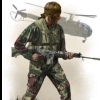
RhodesianScout 189 Posted October 25, 2015 Concept art - Coming in 2016 to the Rhodesia Bush War mod I had hoped to release a video on youtube showing concept art of some of the things you can expect to see while patrolling the map. However the video is not finished yet and some phone calls in the last few hours point to my having a very busy work week coming up. So instead of a video to announce what is coming to this mod.... I will simply post some pictures below of 3 examples of what you may come across in my map. Note : Plans are for these to be fully animated. If you get too close to them they will more than likely hurt you. Animals planned for the mod -------------------------------------- Lion Elephant Giraffe Leopard Rhino Cheetah Hippo Crocodile Zebra Baboon Monkeys Gazelle Impala Hyena Ostrich Sable and more with plans for up to 150 animals that will appear randomly in the map.............. often you will not see any of them but you will hear them. The main aim of this mod is still the fight against terrorists who have crossed the border into Rhodesia....... these animals that will appear from time to time are to enhance the belief that you are actually in the African bush . Concept Art only Concept Art only Concept Art only Share this post Link to post Share on other sites
Alex150201 894 Posted October 25, 2015 Oh crap, it would be awesome to have crocodiles in the mod. It would also be nice if they attacked you if you ever went too close. Share this post Link to post Share on other sites
RhodesianScout 189 Posted October 25, 2015 Oh crap, it would be awesome to have crocodiles in the mod. It would also be nice if they attacked you if you ever went too close. Maleme (ma-lee-mee ) Dam is in the top left of the map......... and as you can see by the sign below if you do go in the water in the game you could easily be attacked by a crocodile if they are randomly placed there........ some thing to think about along with bad tempered hippos before going in the water. This sign will be in the map just to remind you. $40 for a bundle of firewood???? Share this post Link to post Share on other sites
serjames 357 Posted October 25, 2015 Concepts look good. Can't say I agree with the no Shooting animals decision. It's an adult game and seems a little odd we can run around killing people, but not the wild-life, which it sounds like you're planning CAN kill us :-) ? Anyway design decisions aside the map is very exciting as a stand-alone for me - can't wait to get missions ported across ! Share this post Link to post Share on other sites
Alex150201 894 Posted October 25, 2015 Awesome! Good luck dude! Share this post Link to post Share on other sites
RhodesianScout 189 Posted October 25, 2015 Concepts look good. Can't say I agree with the no Shooting animals decision. It's an adult game and seems a little odd we can run around killing people, but not the wild-life, which it sounds like you're planning CAN kill us :-) ? Anyway design decisions aside the map is very exciting as a stand-alone for me - can't wait to get missions ported across ! I removed the no killing animals thing. 1 Share this post Link to post Share on other sites
RhodesianScout 189 Posted October 26, 2015 Based on a true story and a planned mission for the mod....... "Early morning and a lone Alouette Mk III takes off from the army base heading out east over the valley. Just minutes later the Alouette came under heavy fire as bullets flashed up from a clearing below them with one bullet severing the Alouette's tail rotor shaft. Still under heavy fire, the Alouette pilot struggled with the controls as he lost tail rotor control and the Alouette began descending for a forced landing.As they skimmed over a tree top, the pilot saw a group of 6 terrorists ahead of them still shooting at them. With nothing else to lose the pilot swung the crippled helicopter around and aimed the stricken aircraft straight towards the terrorists." The alpha version of the Alouette III is progressing nicely and is shown in wire mesh format below. One of the hardest things with this model is to find a good side-on picture of the Alouette with the Rhodesian colors on it and I may have to photoshop a skin texture from piecing together bits from different photographs. 1 Share this post Link to post Share on other sites
RhodesianScout 189 Posted October 26, 2015 A glimpse of what the Alouette III will look like with Rhodesian colors......... The doors beneath the main rotor are normally open in most pictures I see of the Rhodesian Alouette and my understanding is that this is a sliding door that is opened or closed as required. The Alouette will have an animated sliding door in the mod. The small door next to the pilots looks like that can be detached and I am in two minds whether I have it included with the model or not. Share this post Link to post Share on other sites
jimbop 25 Posted October 26, 2015 good god! have you moddled that chopper while doing the terrain etc?? im having a go at a ww2 burma terrain......proggressing at 1mph at the mo :wacko: i check this thread every 4 hrs.....to say im envious would be an understatement! :wub: 1 Share this post Link to post Share on other sites
RhodesianScout 189 Posted October 26, 2015 good god! have you moddled that chopper while doing the terrain etc?? im having a go at a ww2 burma terrain......proggressing at 1mph at the mo :wacko: i check this thread every 4 hrs.....to say im envious would be an understatement! :wub: I started work on the Alouette almost 3 weeks ago doing a little bit here and there......... work on the terrain had been frustrating me so I have also being doing other models for the mod along with the Alouette. Since then I resolved the issue with the terrain as shown at the top of this page so working on the terrain at 5km an hour...... I think that's about 3.1 mile an hour. I have found the sound I want for the Alouette and as soon as I can get the youtube video done you will hear how impressive this machine sounds. Taking a bit longer to do the video than I had planned. By the way...thanks for checking here every 4 hours and hope that what I have planned for this mod keeps you coming back. Share this post Link to post Share on other sites
RhodesianScout 189 Posted October 26, 2015 Adding roads to the mask. The mask image is used to determine which areas of the terrain map will be dry grass, green grass, granite rock etc and I also need to add the water and road system to the mask. The main area of water in Maleme Dam has already been added and I will check the texture map zoomed in closely to find where the much smaller water holes are that are scattered around the map. It is hard to see where these waterholes are on the satellite map but if you follow the dry stream beds you will find some small and some bigger pools of water. In the picture below I have added a yellow border around an area where there are 5 or 6 different pools of water in an almost dry river system winding across the map to the east. At this stage I am adding in the road system in bright red and when that is finished I save that as a different picture. Then on the original picture paint in all the granite rocks, the different grass and blue for the water holes as I find them. This painting will more than likely override the road textures I had previously traced in red but the final step of the mask is to copy the red lines from my saved picture back on top of the mask so I have granite rocks, water, grass, soil and roads all completed. Share this post Link to post Share on other sites
RhodesianScout 189 Posted October 26, 2015 This is a picture taken in the area where my map is based on so hopefully when this map is done and completed it will look similar to the picture below. Share this post Link to post Share on other sites
RhodesianScout 189 Posted October 27, 2015 Today I am not 100% and have managed to see all my customers early this morning and going to stay in bed for rest of day with my laptop. While this means no work on the terrain today I will use my laptop to spend the day video editing my first youtube video with hopes of it being published on my channel very soon. Mind you I am no J.J. Abrams so the first few videos I learn to do will be for showing what plans are ahead for this map for ArmA III and paving the way for the better videos once the map is well and truly under way. Share this post Link to post Share on other sites