
spookygnu
-
Content Count
705 -
Joined
-
Last visited
-
Medals
Everything posted by spookygnu
-
TerraIncognita is a great one to use. Especially if you have the real world coords to use. You can also use global mapper.
-
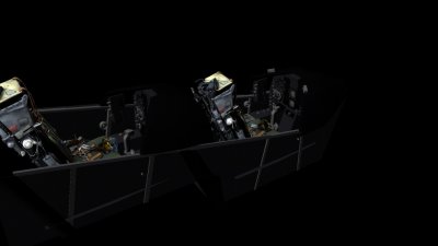
here is a little teaser for you. a small part of over 720,000 trees already placed, and thats not even half the tree population yet. http://images.akamai.steamusercontent.com/ugc/307739466822324378/2D9E32679FAF6C8C1AA3BE48726FCCBEBDD99FFF/?interpolation=lanczos-none&output-format=jpeg&output-quality=95&fit=inside|2048:426&composite-to=*,*|2048:426&background-color=black
-
Making terrain out of Real Life Locations?
spookygnu replied to JFisher's topic in ARMA 3 - TERRAIN - (BUILDER)
you don't really need to globalmapper or Qgis, although they are good, they take a bit of getting used too. ZGM did a guide for arma 2 you can find that on armholic. You can use microdem which is much easier. You can convert the image to a heightmap and save as a BMP then use L3DT. Import it to that and export it as an ASC or XYZ file, ASC is quicker at loading. you can use this thread and tut I put together, there is also reference to other tuts such as the atlas mentioned above to help with the first steps of map making. https://forums.bistudio.com/topic/184422-10-steps-using-opentopography-to-l3dt/ -
You didnt have to qoute me.
-
So after a few months off and my pc deciding to die on me, i lose my source files for the first release of the loop. I have now begun work on version 2. Version 2 will blow your mind. It blows mine at how very accurate this map is compared to the first. V1 was 20x20, V2 is now 30x30km and is 1:1 in scale. RAF Valley is back too, but the locale of valley is now south East on the map. I am again in the process of getting it ready to push out to give you all a taster. At the moment there are no custom textures so you will not receive the dreaded charion error. I WILL BE making this complete with ground troop functionality. All the objects will be there that are needed. Basically it will be more than a flying map. As V2 is so much bigger, i plan to update the ground features per quarter satelite tile. Which is 15360x15360. As you can imagine if cherno is 13x13, thats alot of map to cover and be able to play on at the same time. The first alpha release should be within the next week or so, potentialy with forested areas and some rocks on areas around the loop circuit. If things work out i will try and get most of the forest areas done. Watch this space.
-
UpDate Incoming!
-
looking for some techniques for painting forests on your sat map.
spookygnu replied to wantafanta's topic in ARMA 3 - TERRAIN - (BUILDER)
clone stamping in photoshop is a good one I use. I found that if shadows ever got in the way on the ground I would then create another layer and clonestamp the ground it should be over the shadows. clone stamp is your friend in photoshop for editing RL terrain images. -
Real Light V5 - ReShade Preset
spookygnu replied to Solano's topic in ARMA 3 - ADDONS & MODS: COMPLETE
i think it is page break or scroll lock to activate or deactivate the effect. If I am not mistaken. -
You don'the need charion to use the map. I have yet to get back to this map and begin design on it again. I ceased molding for a bit back in October. Had a new motherboard put in and fresh install of the game. Atm I really can't be arsed to go through the rigmarole of setting my tools up again just to get this map built. Other people have had the charion error but still have it working. There was a post in the release thread about it in the completed section. see here: https://forums.bistudio.com/topic/185351-terrain-mach-loop/page-2#entry2939889
-
Hi all, I would like to bring your attention to a map I am about to release. I am in the final stages of releasing an alpha build. More info on the area I have used can be found in the following link. http://machloop.co.uk/ I created this map for the sole purpose to give all the people that like flying a chance to have a map solely designated to them for training purposes. Scaled at 20x20km in game this map has a 1m resolution satellite image and a terrain cell size of 5m. This has the most realistic looking terrain to date I think. If I'm wrong please let me know and I will rephrase that last statement. For all you sim pilots that like to do it the way you do in RL, the map also features RAF Valley. In RL this is situated on the isle of Anglesey off the northwest coast of wales, but , on the map you will find it at the top north west corner. This also has a sat res of 1m and is as close to real life as possible. I have had to alter the terrain slightly where the airfield is. This is for making it fit. Nothing I could do about that really. But 99% of the map is very very very close to how it is in RL. I have been there. I know! Here's some images. Please be aware though. This map WILL NOT be populated with objects for the full size of the map. It will however be populated on the airfield with hangers, Tower, Barracks and offices. aswell as the usual runway objects. The reason for this is, the map is 20x20km and for you all to experience the speed and have a good FPS rate and use full view distance, I am not going to spend the time filling the map with trees. You get a good sense of realism from just the images only. This map I thought would be handy for live mil-sim groups that have pilots and would like to train and fly sorties at low level. It also has a heli base on the south side of the airfield so heli pilots can test themselves too. Hope you like what you see and I will be releasing it soon. Thanks Spookygnu
-
Runway not showing up on the map
spookygnu replied to J0K3R 5's topic in ARMA 3 - TERRAIN - (BUILDER)
what does your sat map look like over the airfield? -
Need help with TPP road leveling
spookygnu replied to karbiner's topic in ARMA 3 - TERRAIN - (BUILDER)
you could always use the smooth tool in buldozer and follow the road edge. Size the brush to 9 balls (red). scale the brush down until you don't see any of the brush at all, then resize it up using the mouse wheel and pressing 'N', I think it is. Its been a while since I hit up BD. scale it up to 9 so all the balls are red, then just press 'R' and right click, that should smooth it quite easily the way you want. Welcome to the world of no easy way out for terrain making. TPP has its flaws in many ways, and it does say that you need to manually adjust your terrain to suit your needs after you have flattened your roads. -
what an absolute great little tutorial that is. now that helps me out too in knowing what to do if i have problems. Bush you never cease to amaze at the amount of helpful knowledge you dish out. ;) :clap: :icon_w00t:
-
something i thought you all might be interested in and why i was inspired to make the loop for Arma. http://forces.tv/99552191
-
Now that would be a good idea!
-
Sorry for the late reply ss9, my father passed away 3 days before your post. I've been out of Arma and terrain making for the past month. I have fixed the charion error and that will be in the next update. For now people will have to live with it. I am also redoing the lighting configuration on the airfield due to me using the wrong coloured lighting for the taxiway. At the moment I have built up the buildings using a3 objects and mapped out the road network. In the next update I do have the road on the map that follows the aircraft route so it's not to hard to lose your way. I just haven't sorted out the terrain underneath. Don't mention terrain processor. It's a pile of sheep @#$& atm. The next update will have various tree areas too. So it shouldn't look to plain as you fly around. Regarding the Ivory stuff, please read post 17 by me about those. But I do know they work. Thanks for downloading and enjoying my creation of a RL location. Spook.
-
You might need to smooth the ground out. I know with runway objects if the ground is offset above the object i need to smooth it out to it doesn't clip through.
-
How can I create my own ground texture?
spookygnu replied to _Krok's topic in ARMA 3 - TERRAIN - (BUILDER)
If you type mindtex in steam you can get a good tool there. I asked this on the skype channel. Bushlurker pointed me to it. Works just as good and saves you 95% of what crazy bump costs. The program works using sliders, so you can basically play around with what textured nopx file you want. -
Layers generation - Unable to load file "P:\"
spookygnu replied to slawterer's topic in ARMA 3 - TERRAIN - (BUILDER)
He also needs [ ] infront of = -
Layers generation - Unable to load file "P:\"
spookygnu replied to slawterer's topic in ARMA 3 - TERRAIN - (BUILDER)
Lol! Set up ya p drive! Rebuild ya p/drive! Check this checkthat, and all it was was a typo. Nine times out of ten it'll be a typo. No need to do all the other if your files are all sorted and in the right place. Sometimes it does take an extra eye to find to mistake, which is what the forum is for ain't it? Well spotted jimbop. My point really, is don't panic about it. User error happens all the time. If your p drive works and you don't have issues with it. Leave it alone. If its not broke don't fix it. Typos always happen, post your query take a breather and make a drink. Someone else will find it if you become blinded by code. Happy days! -
Think the topic title might be abit misleading??
-
Map builder is great tbh, I have used it alot, but as I tend to be in buldozer alot also, I find I'm sticking to it due to terrain altering. If I place anything using map builder I can easily export the objects and re import to tb if I wanted too. Map builder is easier to operate and doesn't take to long to learn. Neo has made it very user friendly and is constantly improving it for the better of the user. Another thing aswell, X-cam I think, was made by an industry professional which goes without saying that it is of a high calibre and very robust for being a object orientated tool.
-
Is it possible to lock terrains
spookygnu replied to ll Mysterio ll's topic in ARMA 3 - TERRAIN - (BUILDER)
Yes if you subscribe to mikeros tools. Pboproject pro can obfuscate your terrain so no one not even yourself can unpack it. Check devheaven or google mikeros tools. I don't have the link right now i am on my phone. -
As good as they are for placing objects. Personally i find using buldozer as para said you can alter terrain if needed. You don't have to pack it up and wait half an hour before you see changes.
-
I didn't rebuild the terrain. I read that you import i through tb as an object. When i did that it appeared in the raster layers. I then hid the other layers so i was looking at the new one. I closed the sat and mask window so i was looking at the heightmap. I then hid the roads shp layer and kept clicking it on and off in various areas to see any difference. NOTHING! No change whatsoever.
