

Nicholas Bell
-
Content Count
396 -
Joined
-
Last visited
-
Medals
Posts posted by Nicholas Bell
-
-
Well my estimate was way off as I am approaching 700,000 objects now,and am no where near done. Probably will be closer to 2-3 million when done, if it can handle it. Sure hope so, as I would hate to lose this map, not to mention all the time spent on it.
-
Sorry, this is not possible for a myriad of reasons. Â Stop by the Visitor 3 folder and peruse the topics over the last year if you are really keen on knowing "why not".
-
Looks terrific Bravo 6. I mean really good!
-
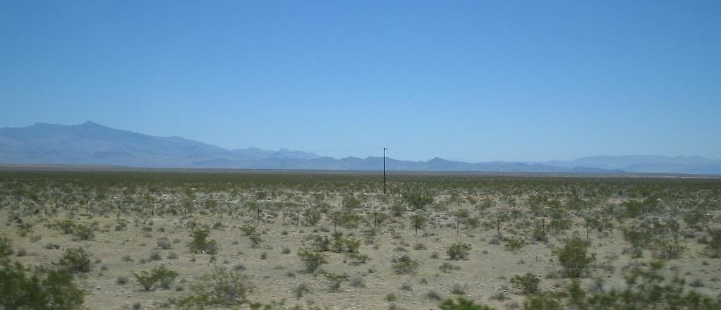
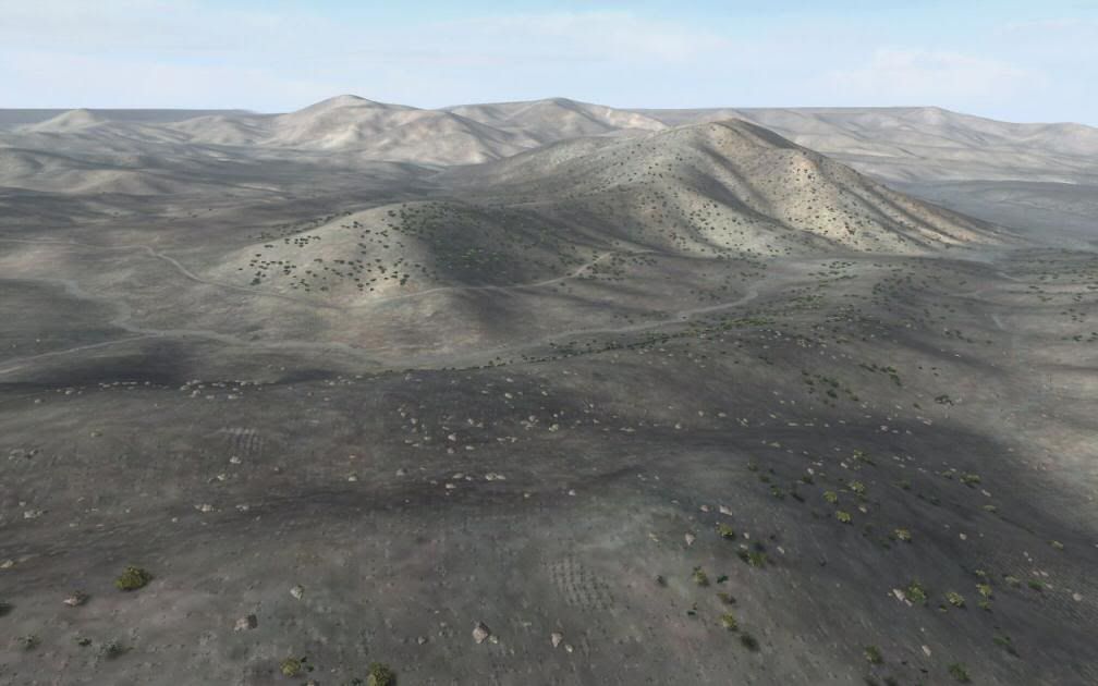
Here's a real photo of Nevada if your keen on capturing the right amount of vegetation clutter,
-
Nice idea, OPX. Looks great. Did you use 10 meter SRTM DEM? What is the resolution of the sat image? (or how do you handle a 40,960 x 40960 pixel image?)
-
Well that's good info to know. Â Getting concerned about the number of rocks and plants on Razani - hoping I can keep it under a half million, but that's not likely once I start adding structures.
Should have stuck with a 5 km not a 10 km square map....

-
Damn you Opterxy! Â
 Â You leave me in the dirt. Â How the heck do you create some many fine maps in so little time?
 You leave me in the dirt.  How the heck do you create some many fine maps in so little time? -
Well, I can never get the roads quite smooth enough!
A work around might be to use the random height script on the areas around the road, and then smooth the roads minimally. The higher the value one puts in the road smoothing script, the less smoothing applied.
-
Well, back from vacation - a week hiking in southern Utah, which happens to be very similar to the map in many respects. Â Nearly the same latitude. Â Same elevation, topography and climate. Â Even the vegetation species are related. Â I've been hiking in the desert and mountains as an annual event for many years, and as a collector of topo maps and a map-maker for other games, I've always payed close attention to the terrain (apart from avoiding getting lost <g>). Â But this is the first time I have had an opportunity to study similar terrain while working on a specific map. Took over 1000 photos to help, along with some measurements. I definitely have rethink the rock/boulder placement. Â Sure wish the program could support a smaller elevation grid on a large map - 10 meters will simply not allow a proper representation of how rough the terrain is. Â Even "flat" desert isn't flat - unless it is a salt pan.
It is a 10240 x 10240 meter map with a similar size satellite image.  Using a 1 pixel  = 1 meter satellite image is important.Quote[/b] ]What is the dimension of your sat? and your project?
There are 5 basic masks - dark sand/rock, light sand/rock, lighter sand/gravel, riverbed gravel and "farmfield".  The sand/rock masks have 6 different clutter models assigned.  For the farmfields I am currently just using  a high thick grass.  The lightest sand/gravel mask has no clutter so I can have areas around buildings and roads without the weeds and rocks growing out of the roads and buildings which sometimes happens.  The riverbed mask is a custom gravel texture with several clutter models of small rocks to keep it looking totally flat. In other areas away from the farmfields and sand/gravel I have additional masks for the mountain rock. Apart from the riverbed texture, all the texture masks are standard BIS textures with the colors modified.  I have also taken the standard BIS rocks and changed their colors to better match the mask textures.  The large plants and rocks are all individual objects placed mostly with the random placement script.Quote[/b] ]In your MASK_LCO are you using a specific colour for vegitation and rocks or are you maually placing all of the objects in Visitor 3 -
One other thing which caused me similar fits was when I added another harddrive and found out that Visitor and Arma have to both be on the C: drive for them to work. At least for me.
-
Bravo 6 -
Not sure about what you mean by selecting a road to introduce random height variations, given you want to smooth roads. Â Although you probably already know this - no insult intended - [APS] Gnat's Edit Vertices Height v2.0.1 at the top of this thread does the random height modifier, among other things. Â I usually use a .67 setting with Add/Subtract Random Value. Â You have to select areas using F5. An excellent script.
-
I'm away on vacation the next week so there will be no new updates for a couple of weeks.
-
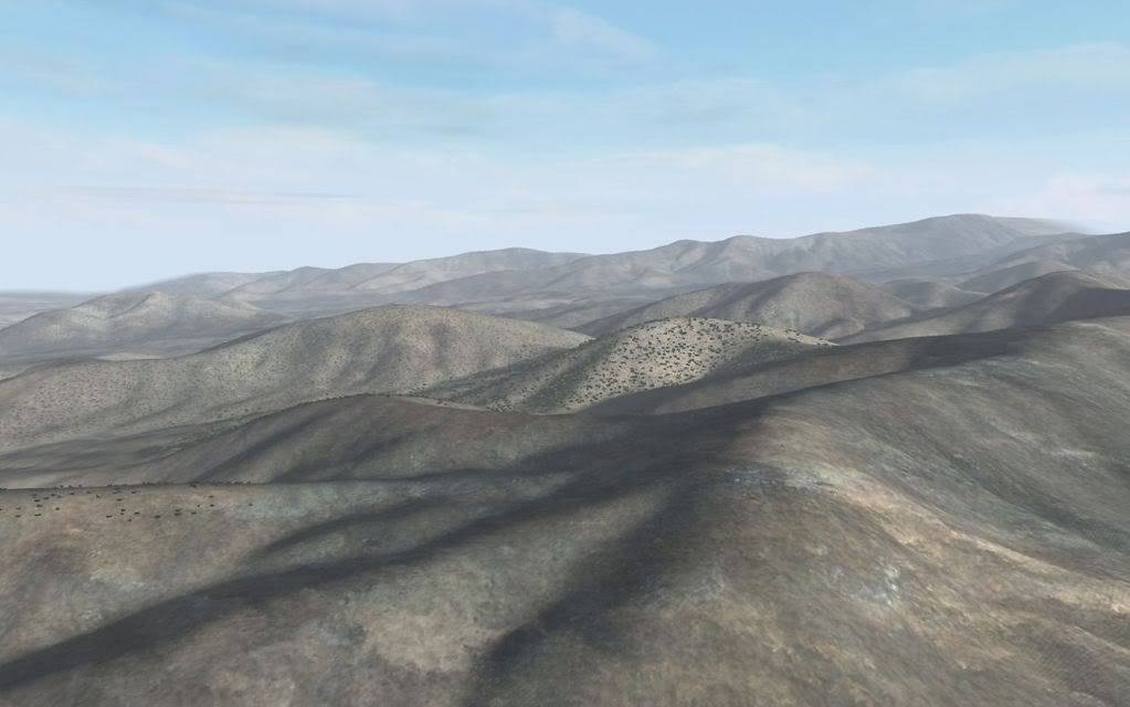
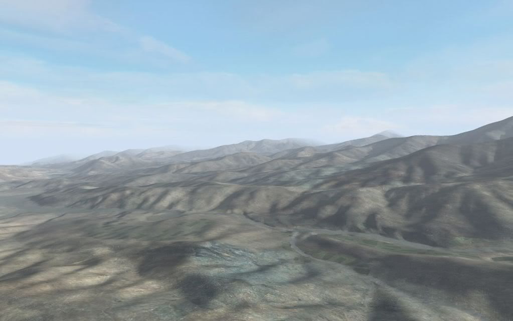
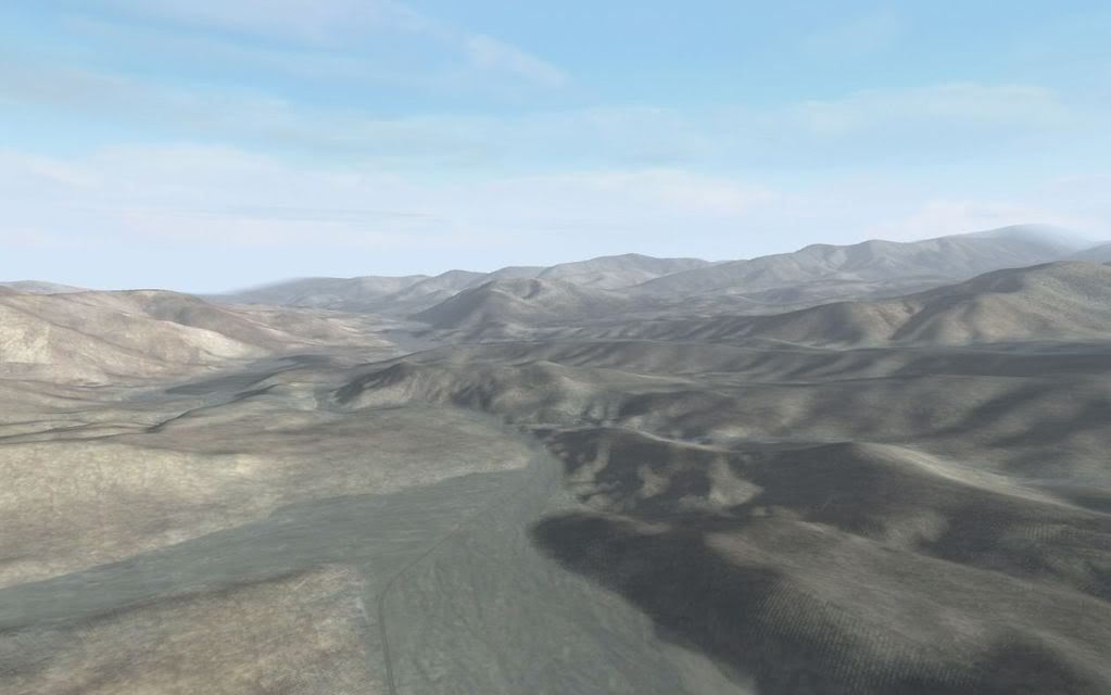
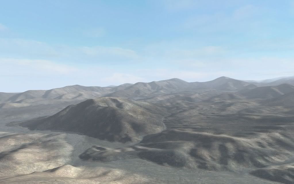
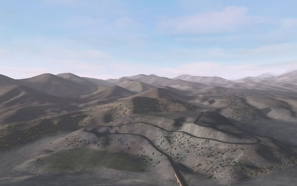
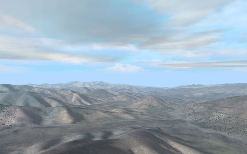
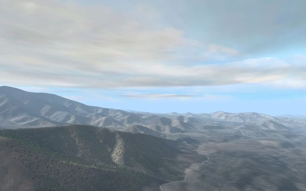
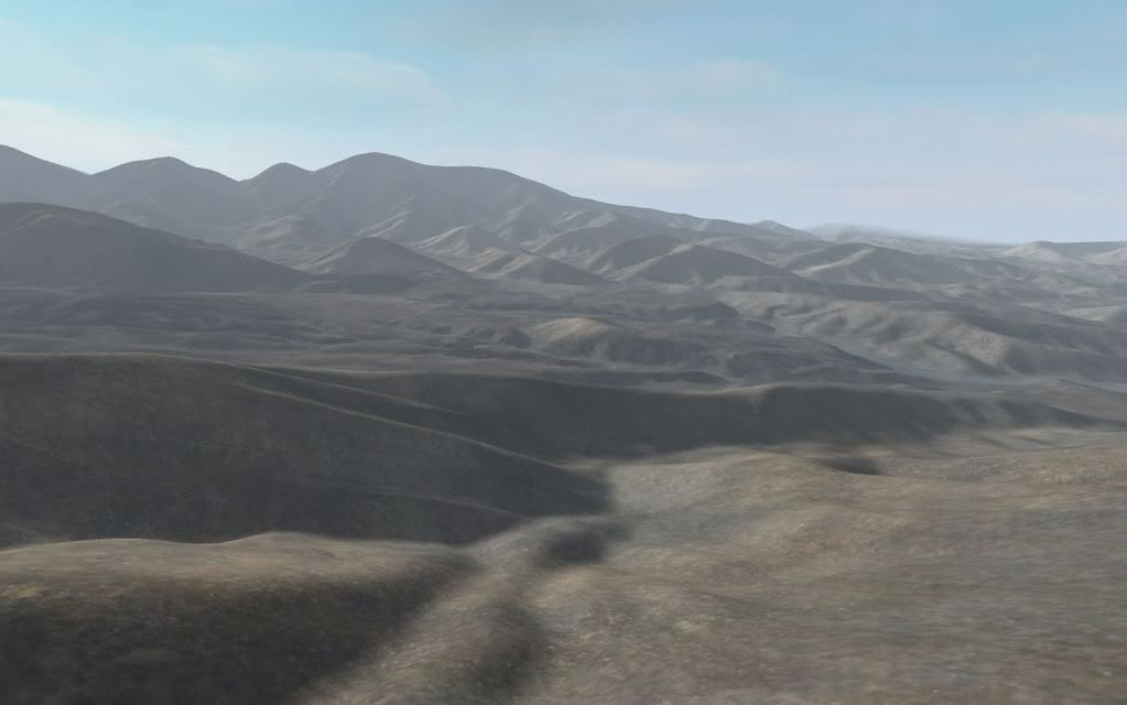
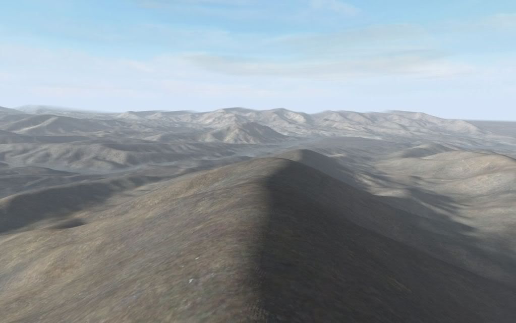
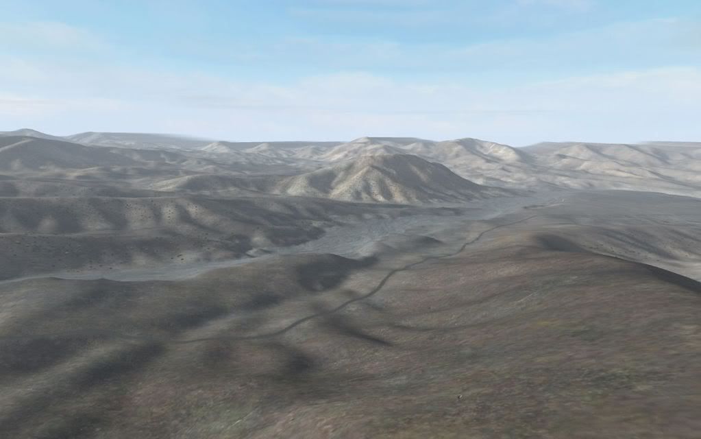
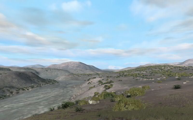
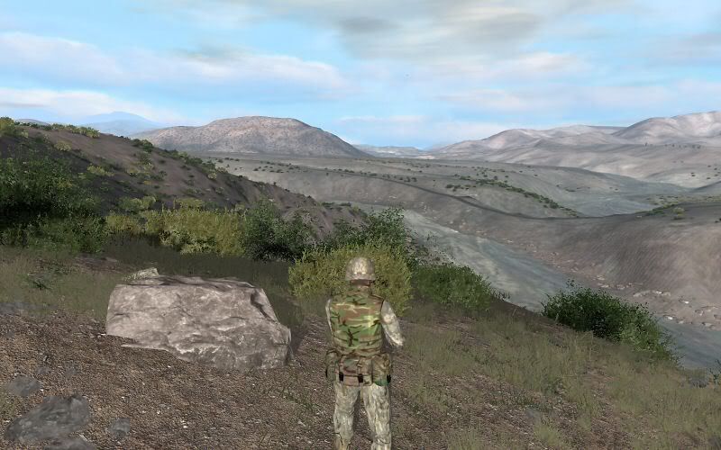
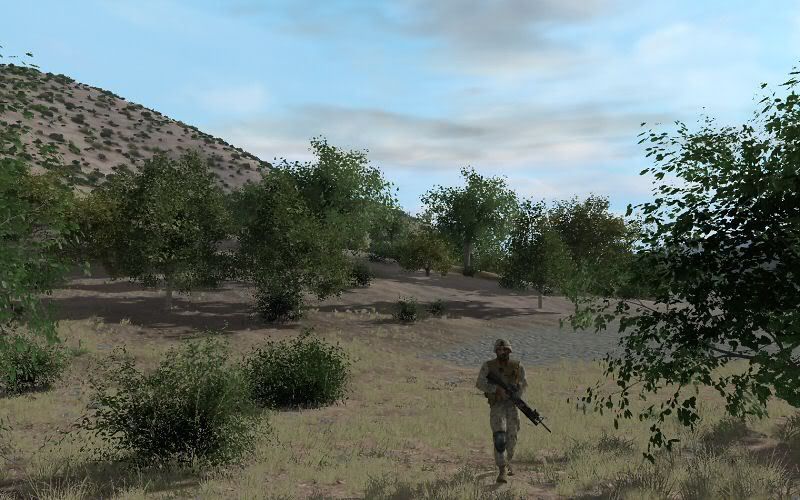
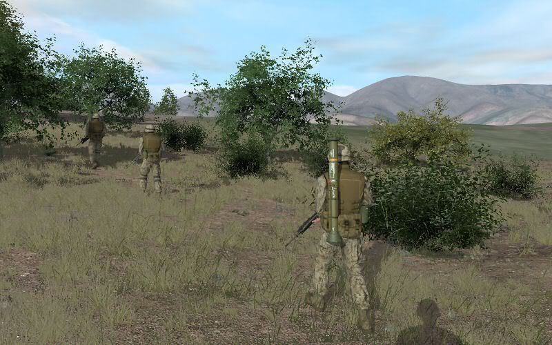
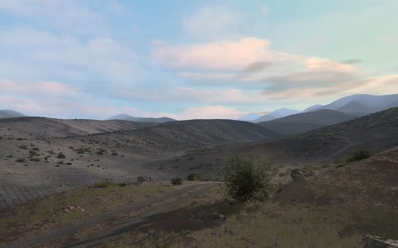
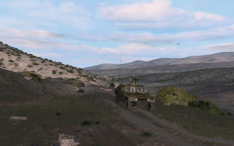
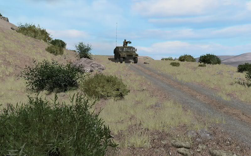
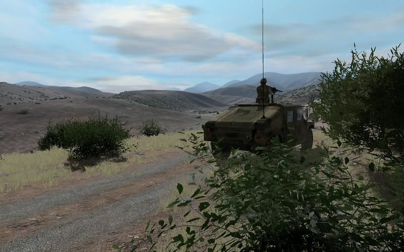
No one will mistake these images as photos of real places for sure, but I post these less picturesque images to help you understand how rugged this terrain is. Â Yet it still has plateaus which are several square kilometers. Â The river beds (washes) are sometimes 4-500 meters across - real kill zones for infantry.
A comment on the discussion above - I don't make the map to "be" anything but as close to reality as I can within the constraints of the game engine. Â That is, I am not designing the map for any specific type or mode of play. Â There are areas which are wide open and deadly for infantry. Â I've had long range engagements between forces on opposing ridgelines at ranges exceeding 500 meters. Â I've played missions where I held the hilltop and the AI attacked. Â With all the undulations, ravines, ridges etc, you would be surprised at how the enemy can disappear even when you hold the high ground. Â Finding the military crest as opposed to the topographical crest is important! Â Anyway, I try and take down as many of the attackers at long range before they "disappear", because once they do they will sneak up on me and give me a good surprise if I just sit in the outpost. Â Important to patrol around to see where they are. Â I have seen the AI infantry move around and not necessarily climb the hill directly when using seek and destroy waypoints.
I see this map being best for small scale actions - raids, ambushes with insertion via air or by foot (which can take a while given the size of the map). Â This is not good tank country, and vehicles should only be found around the main highway - targets for ambushes.
Note the images below have the time set for either 7 AM or 5 PM and the shadows are all ArmA generated - they are not shadows from a Google Earth image used as a sat_loc file. (which look great in still shots when used but not so good when the time or sun direction is different) Â You can also see how the "edge of the map" looks - the visible range in the images is 10 KM.
-
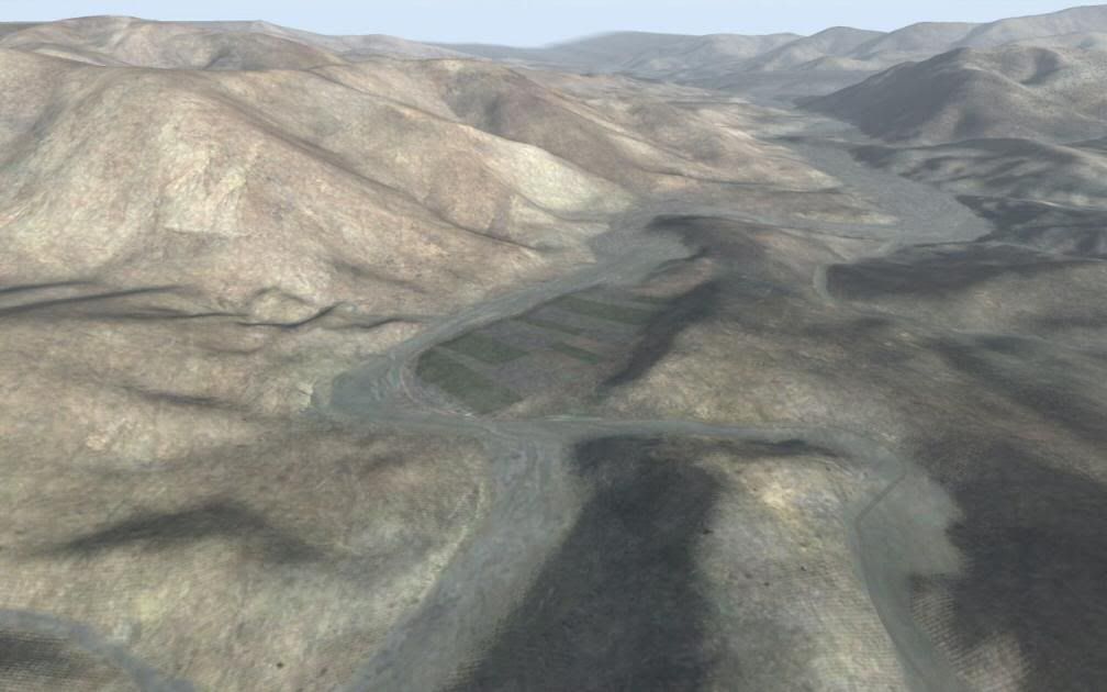
Not much new and interesting to show for this week - more work on the mask and satellite image. Â Added about 40,000 bushes and rocks with several hundred thousand more to go.
Not all areas are going to get vegetation, but here is where I am now:
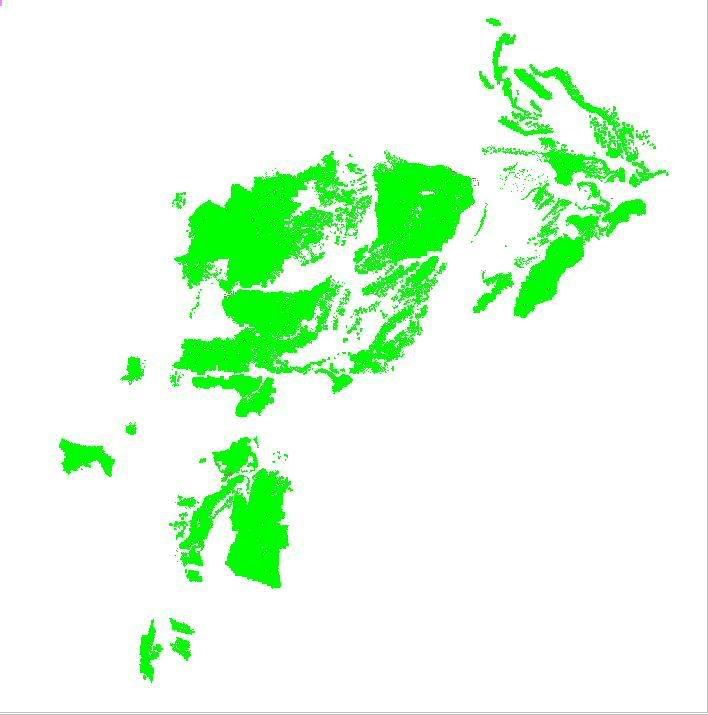
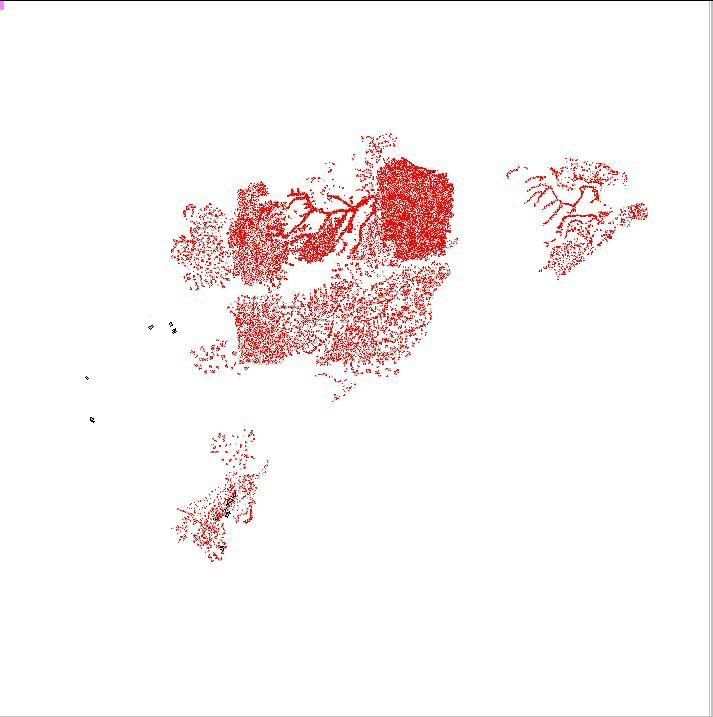
A better indicator of completion is how far I am in placing rocks:
-
Sahrani is 20480 x 20480 pixels, where each pixel equals one meter on the mask/sat images. Â The terrain grid size, which controls the elevations, is on a 10 meter grid.
One can make a larger map if you increase the size of the elevation grid or the scale of the mask/sat images. Â The downside of this is much less detail in the terrain and less attractive map.
One thing that needs to be stressed is that the size of satellite image is the key bottleneck in map sizing. Â You have to be able to work with the sat_lco.png, with multiple layers. Â The layers are needed to coordinate the mask, sat_loc and the objects, roads, coasts, etc together. Â While Photoshop CS3 can handle this (if you pocketbook can handle buying the program), it is still extremely slow in loading and saving multi-gigabyte size. For example, a simple 20480 square pixel png file takes over 20 minutes to save on my system.
I tell everyone who asks about how they can make a map like Schmalfelden or Razani to first test their graphics program to see if it can handle a 3-4 layer PSD file sized according to the size of the map.
Also be aware that even a small detailed map like Schmalfelden can easily take hundreds of hours to complete. Â I can only imagine how much time Opteryx spent on Avangi. Â I would really recommend starting with a small map first to get a handle on the process.
-
Thanks - hope it meets all your approval when you get it in hand!
Rocks - understand. Â I'm not done yet. Â Next week I'll get some shots with completed rocky areas. Â But some areas are pretty smooth - following the real world image best I can.
AI Pathfinding - As noted early there is not problem for leg units at all. Â In fact they look more intelligent than they really are

Vehicles, unfortunately do not understand that they should not drive up steep hills or cliffs. Â They will need plenty of waypoints - especially on the hairpin curves (which I have not shown yet).
I honestly have not had the time to look at MapFacts 3DE. Â I was under the impression it was more for use in placing objects on existing maps for missions, as opposed to creating maps.
Villages - as noted earlier in the thread, the area has a lot of small villages and compounds all over the map. Â I wouldn't be surprised if Bin Landen was hiding in one of them. The recent US strike in North Waziristan was off map to the upper right. Â This area has been under Taliban control for a long time, and may be the future target of the Pakistani Army. Â Guess no one has made a mod for them yet.
The rivers do not have water - they are dry. Â They only have water in the springtime during the snow melt. Â There are portions of the rivers with smooth slopes down to the riverbed. Â These areas usually have villages and small farmfields. Â The steep canyon slopes are not my doing - blame nature
MrCash2009 - sorry it's not Jolly Old England. All dry and nasty, I know it's a disappointment. Â

-
-
-
Sorry, no new images to show. Â Working on more mundane things like the mask. Â I had the map mask setup with small 256 pixel segments but that was causing stuttering every few seconds while flying over the map. Â So I've had to change the mask segment size back to 512 pixels - no performance problems there. Â Since the ArmA can only have 4 textures per segment, this has a big impact on how varied the ground will appear. Â With the smaller segment there are of course more of them (segments) covering the map, allowing for more opportunities for different textures fairly close together.
A typical example is where I have a  road shoulder texture (necessary to stop clutter objects from "growing" in the road), dry riverbed, and farm field.  That's 3 textures, leaving only 1 texture for the rest of the terrain in the 512 square pixel segment.  With a 256 pixel segment I could often isolate the farm fields in their own segment, allowing for 2 base textures in other areas.
Maybe this is more information than you want to know
As far as scrub placement, in addition to "hand" placement, Â I am using the random object placement script with varying densities to match the actual density, if not the exact placement.
And although I know "caves" are on people's want list for this map, that's way down on my priorities. Â I've looked at Oxygen enough to know it's nothing I'm going to learn easily or quickly. Â Whole different skill set than map making. Â I have managed to re-colored rocks in their own PBO to better suit this maps terrain colors. Â I know it's laughable, but that was quite an accomplishment for me!
-
If the converted paa files are already in the Data/Layers folder Buldozer does not need to convert them.
Did you import the cfg, sat and mask files before starting Buldozer?
-
The only way is to use the object pond.p3d found in the ca/misc folder. Â You can enlarge it up to 500 percent and use several to cover a larger area. Â Note the getting pond objects set at the correct height is dependent on the elevation of the surface beneath - the bottom of the lake.
You can check out my usage of the pond.p3d by checking out the Schmalfelden source files. Â Opteryx has also made use of them - you can find one on his Avgani map.
EDIT: Opteryx answered while I was typing
-
The "fix" works fine, although it was a problem only on one system. Â On the other computer the "black" was just a deeper brown - I didn't even notice it as a problem.
I love your attention to accuracy and detail on this map, Opteryx. Â Outstanding work - you're "The Man" Â
-
Okay, I dropped back to 512 pixel segments and the stuttering went away. Â It also loads much faster.
However, I also reinstalled ArmA on my old computer and I do not have the stuttering problem when using 256 pixel segments. Â Go figure.
-
Thanks, guys!
All the images are in game. Â There isn't any real difference in the terrain between eastern Afghanistan and western Pakistan, so my thinking was that it would be a good area for both fields of operation.
The terrain works well for AI soldiers (vehicles is another issue - they seem to want to climb up cliffs instead of going around the hill). Â I've had long range battles from hilltops and between ridgelines. Â At the same time the terrain is rough enough in most places that it is easy to close with the enemy if one side does not have a height advantage. Â Even so, the vegetation and rocky terrain provides plenty of cover & concealment without causing any pathfinding problems for the AI. Â Makes them look smarter than they really are and provides a good challenge. Â I've played up to platoon size engagements without any framerate problems, keeping the view range around 7 km.
There will be plenty of habitations on the map...eventually. Â There are towns:
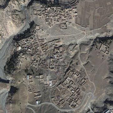
Scattered compounds:
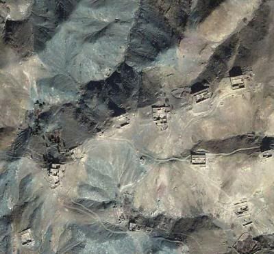
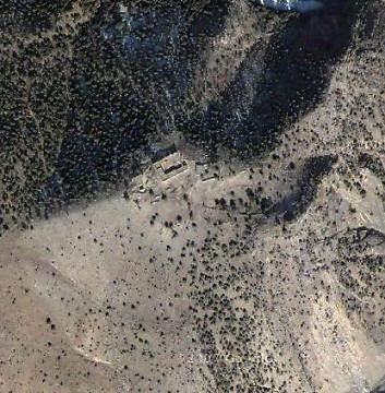
And mountaintop compounds. Â These folks take the expression "a man's home is his fortress" literally.
I plan to get most everything done except the buildings and then release this as a beta. Â That way everyone can get some use out of it sooner rather than later, and with a real time editor it possible to setup your own compounds. Â I will continue adding the towns and compounds and releasing updates as I complete areas. Â At least, that's what I'm thinking at the moment.
While recreating the caves of a Tora Bora type complex would be great, it would require modeling skills I truly lack. Â I'm behind the power curve on this as it seems many mappers have also taken on creating their own models. Â Looks like I may in the future eventually have to break down and go down that road too. Â Never enough time to do everything I would like to.
Razani, North Waziristan Map
in ARMA - ADDONS & MODS: DISCUSSION
Posted
Okay, I can take a hint Â Still chugging along here. Â Seems a rather endless task just putting in all the vegetation.
 Still chugging along here.  Seems a rather endless task just putting in all the vegetation.