

Nicholas Bell
-
Content Count
396 -
Joined
-
Last visited
-
Medals
Posts posted by Nicholas Bell
-
-
Solved my problem, and like I thought, it was "simple". Â In order for the selected faces to be "set" in the UVeditor it is necessary unselect them in O2 (click on an empty spot) *before* selecting new faces.
-
Attempting to teach myself how to do this stuff. Â I was following the RIP31st method (not unwrapping really). Â My model is a simple wall - all flat surfaces. Â I select a face (either using 't' or using F3 and selecting the associated vertices), switch to the UV editor and hit 'tab' and the selected face appears no problem. Â My hangup is when I select another face, the first disappears (the outline in UVeditor). Â Obviously a real basic misunderstanding on my part about using O2. Â The tutorials out there are good in explaining the concepts, but assume the basic understanding how to get these done in O2.
-
Real basic question. Â How do I get the selected faces appearing in the UV editor to "stick" so I can select another set of faces? Â Simply put, when I select one side of my object, it appears in the UV editor fine. Â When I switch back to O2 and select another side or top of the object, when I go to the UV editor the original selection has been replaced by the second selection.
Thanks!
-
Thanks for your hard work and continued support of your GL3. Â Sure glad you enjoy scripting
 Â Â I don't find much time to actually play ArmA (pretty focused on map/island making, really), but the few simple infantry based missions I fought recently have been a great experience.
  I don't find much time to actually play ArmA (pretty focused on map/island making, really), but the few simple infantry based missions I fought recently have been a great experience.What is the maximum distance a reinforcing unit can be away from the calling unit?  For example, can I place a helicopter 5 km and still get it to react?  Or is the reaction based on the sound ranges you listed in the readme?
-
Quote[/b] ]Leveller looks good. It appears user friendly and conducive to large terrains. Â When you are finished in leveller how do you then get it into Visitor ?In Leveller, simply export to a greyscale PNG heightmap. Â Then import this in Visitor. Â The heightmap dimensions and elevation heights are defined in the Visitor terrain.pbl file.
Quote[/b] ]there's also a plugin for google earth that captures DEM data, and saves it out as a heightmap, im not too sure at what resolution though, but it could be possible to finish it off in photoshop or use it as a base in a terrain editing program.The download sites for the STRM DEM data tied to that plug-in no longer work (at least last time I checked). Â Better to go to: http://seamless.usgs.gov/
The DEM data has to be scaled to whatever grid you are using to create your island/map - usually 10 or 20 meters. Â This scaling process is most easily done using MicroDEM, available free here: http://www.usna.edu/Users/oceano/pguth/website/microdem.htm
A deep search in this forum using MicroDEM, DEM, Wilbur, etc will provide a lot of information on how to get from raw DEM to a Visitor usable heightmap.
Of course raw DEM isn't exactly what you want to use in making a map because in most cases it is "smooth" - Â it is based on a 90 meter elevation grid. Â The points between are interpolated. Â To create realistic terrain one needs to use erosion routines to naturally sculpt the terrain. Â Most heightmap generators have some form of erosion routines. Â I've found that Wilbur's and Leveller's are the best at producing realistic results.
Note that the US DEM is based on either at 30 meter - or in a few areas, a 10 meter grid, which provides a much more realistic heightmap to start.
-
Wilbur is free and quite powerful. Â UI not real friendly, though.
http://www.ridgenet.net/~jslayton/software.html
I also use (and really like) Leveller, but it costs $150 US:
-
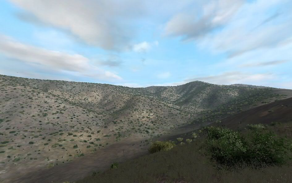
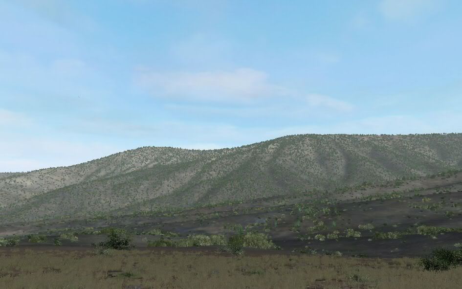
Everything visible is a WIP.
Patrol on Wireless Ridge. Â The patrol leader is not happy to have his photo taken.


-
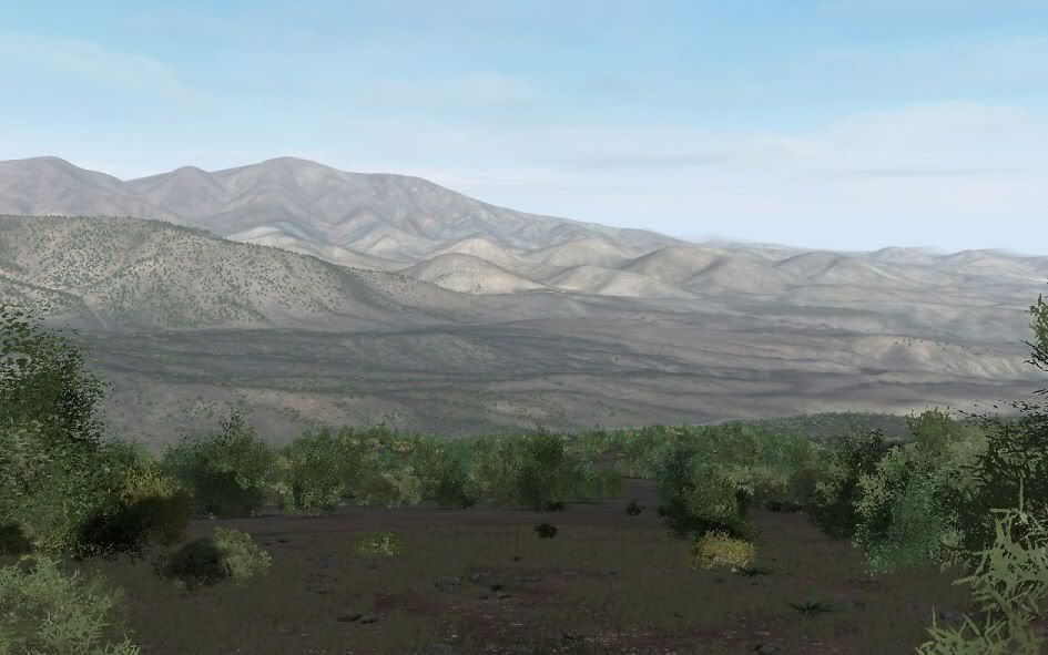
A crappy 9 min. video of flying over the area. Â I don't know jack about making movies as you will see... Â but at least it gives you more of a feel for the terrain than just more still shots.
Not sure what the heck I am doing wrong. Â Video looks fine after converting/encoding it, but once I upload it to YouTube it looks like crap. Â Vimeo looks only slightly better - don't go full screen though...
BTW, it may appear choppy in a few spots but that was the effect of turning on Fraps to make the video. Â Without video recording is maxing out at 60 FPS with 7100 meter view distance. Â Other reports from testers are positive regarding the lack of lag and being able to jack up the view distance.
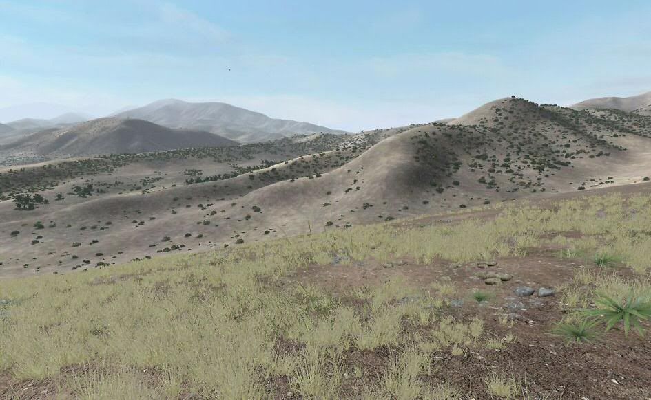
Making progress. Â Over 1.3 million plants and rocks so far. Â Fixed some nagging config problems too. Â Working for an initial alpha release somewhere after the first of the year. Â This initial release may or may not have buildings on it. Â But follow on releases will.
-
Nice looking tree, MikeBart. I wish there were more folks like you who were interested in creating environment models. I am ignorant of 3D modeling, but look forward to using your tree on one of my maps someday
-
Might fine looking, Opteryx, for an "early WIP". You make it look easy...which it isn't. S!
-
Although it burned up a lot of what few brain cells I have left, I fixed the config problem which was causing the hang during program load. Â The problem was my clutter type probabilities totalled 100%...go figure.
Still stuck on the initial flare/burnout problem. Â Thought it might be the riverbed texture since it's the only one I made from scratch. Â Replacing it did not do the trick. Â Interesting, when I exit a mission and the editor, the "movie" made from the last mission starting position momentarily has the NOD graphics.
The riverbed has a roughness value of .25 - normal ground is .10, so it (the riverbed) should be slower. Â But why you don't get the road/track bonus (roughness .01) when on the gravel road I don't know...
Added a few more tens of thousands more bushes and got rid of that stray hotel. Â In case you see one, the reason for this is that every time you click on the map in Visitor, it does something. Â Default is to place an object - the first object in list. If you have the objects turned off, you don't see what you place when you click. In order to zoom into a spot you need to click on the map, it's no wonder that you find a stray hotel now and then. Â I set the hotel as the first object since it is large and easier to find. If I'm in vegetation mode, I end up with a stray bush instead of a hotel.
-
I ran an SOS-CEX "capture" battle last night with artillery and Mando air strikes without out a problem. Â We took the hill first. Â The bad guys launched a portion of their forces against us and infiltrated around to "win". Â My flank squads failed to keep them from doing so.
Great time - although I know I should be working to complete the damn thing not enjoying it. Â

-
Need some help getting this setup for use in Visitor. Â Situation is:
1. Â Have a map partially completed in Visitor not using 3DE.
2. Â I use the Visitor Project | Import Templates and load 480 dummy templates.
3. Â Now I am supposed to run the OED_Import_Templates script, but I do not understand what file I should open to execute the script on.
The directions simple say:
"In the following dialogue you need to navigate to your
Visitor-script, which you have generated in 3DE, and click "OK"."
I have no idea what this is.
Thanks.
-
Thanks for posting those great images, MrCash2009!
Up to over 1.2 million objects and still no problems with lag. Â I slipped up and instead of working on the map I played a simple "hold the mountain top" mission against the evil hordes. Â Great fun and although I am hardly an unbiased source, the battlefield looked good too Â
Back to planting bushes across the lands...
-
Really beautiful skies - thank you!
-
I've had that problem if I made real long roadnets or ones with multiple intersections. I just limit the length of roads and overlap the ends of the different segments.
-
The texture rvmats are created automatically when you import the sat and mask images. Â Double check your Tools | Project Preferences | Folder Textures is correct. Â It should end in "data", eg my current project Folder/Textures is p:\ca\razani\data
-
Fixed that. Â Yes, I wasn't paying attention on the image size. Â No excuses, sir.
-
Looking terrific there, BB. Outstanding ground texture you've made too. It's that kind of attention to detail which brings a map to life.
-
Great photo, thanks! Â I think this just a little farther north on the border (not sure which side <g>), given the wet river and green grass. Â But the terraced farm fields, juniper trees, etc are spot on to the area I am attempting to simulate.
BTW there's no way to do terraces in ArmA, so the fields will be just farm fields  Not even sure I will wall off the fields given the small size of the fields (ie, lots of walls).  Drive the AI crazy, I'm sure.
-
Quote[/b] ]ust wondering, would it be possible to get the map with without buildings (better as source file), so people could play around with 3DE and hit own versions of it?This is exactly what I have planned. Â First version with everything except buildings. Â Next version with structures. Â As with Schmalfelden, I will also release the Visitor source files (for both versions).
-
Thanks, guys! Â Hope it's not a disappointment when you use it
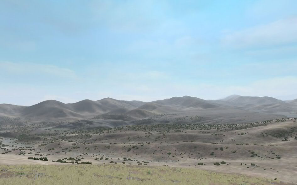
Performance: Better than Schmalfelden forests Â
 Â Â It's fine, but since everyone's system and settings are different, it's kind of hard to predict. Â I am concerned about how it's going to work when complete with 1-2 million objects. Â Only way to know is to complete it and find out I guess.
  It's fine, but since everyone's system and settings are different, it's kind of hard to predict.  I am concerned about how it's going to work when complete with 1-2 million objects.  Only way to know is to complete it and find out I guess.Placement:  Some by hand, but mostly by random object placement script.  But not just cover the map and go.  Instead many small areas are defined and different densities are selected for each.  And repeated until the area is "filled".  Actually there is no way to put the actual amount of vegetation on the map that would exist.
This is what I wish I could reproduce:

3DE Tool: Â No doubt a coding masterpiece, but a bit much for my fossilized brain to grasp. Â Obviously I need to spend more time with it, but there's not much available and the lazy side of me says keep working with what you know.
Settlements and Roads: Â Roadnet is in place - look back in the thread. Â Eventually I will put in the compounds - again, see above. Â I want to finish the terrain and release the map so it can be used for some purpose while I finish putting in the buildings.
ArmA II - I sure the heck hope this will work in it, or at least with minimal modification. Â No doubt we will all be (eventually) migrating to the new simulation when it is released, and it would be sad to leave all these maps/islands behind.
-
No easy answers for this one. Â Using the height map to create an elevated road embankment means the width will be the size of your cell (usually 10 meters). Â Not only too wide but looks bad when the road is angled - the embankment gets saw-toothed.
I supposed someone with modeling experience might be able to create an embankment object on which the road might be placed. Â Much like the existing bridge objects.
-
ArmA Photography I - No images over 100kb.
in ARMA - GENERAL
Posted
Taliban in North Waziristan
Lost Brothers Taliban & Razani, N. Waziristan Map (WIP)