

RhodesianScout
-
Content Count
263 -
Joined
-
Last visited
-
Medals
Everything posted by RhodesianScout
-
[WIP] Rhodesia Bush War
RhodesianScout replied to RhodesianScout's topic in ARMA 3 - ADDONS & MODS: DISCUSSION
During certain hours of the morning and given the right weather conditions a script will add fog to the map. This will make early morning missions into the valleys more interesting and more hazardous if ZAPU or ZANU terrorists are camped in the valley. Testing level of fog and fog runoff. -
[WIP] Rhodesia Bush War
RhodesianScout replied to RhodesianScout's topic in ARMA 3 - ADDONS & MODS: DISCUSSION
Completed final tweaking of terrain heightmap and now happy with the map....next step is to add a little life to the map by adding grass , trees and thorn bushes. -
[WIP] Rhodesia Bush War
RhodesianScout replied to RhodesianScout's topic in ARMA 3 - ADDONS & MODS: DISCUSSION
With all the videos I have watched of Arma III I think this is the first time I have actually spotted a rainbow in Arma III. This picture also shows an issue with the terrain on the left hand side of the picture on the horizon...... this appears to be the edge of the map causing this. Will fix that this afternoon. -
[WIP] Rhodesia Bush War
RhodesianScout replied to RhodesianScout's topic in ARMA 3 - ADDONS & MODS: DISCUSSION
In a somewhat less hilly part of the map all this rabbit could do was look off to the sun setting in the west. The height of the hills has been reduced by around 25% as I ran a test with a patrol and the terrain was a little too steep in some places ........doing some more tests today. -
[WIP] Rhodesia Bush War
RhodesianScout replied to RhodesianScout's topic in ARMA 3 - ADDONS & MODS: DISCUSSION
The first picture in the last couple of posts was taken in an area of the map which is flat and will be covered with trees and thorn bushes when done. Though the ground is more to the soldiers liking the dense bush still makes this a rather difficult area to cover. When this area is finished there will be trees and bushes spread as far as the eye can see and large granite boulders spotted on the ground will provide perfect cover for terrorist snipers. The last 2 pictures show the more rugged part of the map with tall steep hills which make the journey for the infantry a lot more challenging. Each hill can be climbed but if you go up the wrong side of the hill you may find this more difficult to climb. Ideally you would want to walk around the hill to see which side is the easier to climb but if you are sneaking up on an enemy camp you may not be able to do this. Before you climb up the side of the hill you may want to look up and check to see if there is anything on the hill that will prevent you getting to the top. Many hills will have dense vegetation somewhere up the slope which you may get around but some hills will have dense and impassable vegetation or boulders blocking further climbing up that side. In that case you would need to find another way up. -
[WIP] Rhodesia Bush War
RhodesianScout replied to RhodesianScout's topic in ARMA 3 - ADDONS & MODS: DISCUSSION
Following are 2 more pictures from the Rhodesia Bush Wars Map Early morning and the Rhodesian Infantry patrol breaks camp and moves over the crest of the hill as the sun begins to rise over the horizon......... 30 minutes later the patrol find themselves on the top of a steep hill with a sheer drop off to the side....... one false step and their day will be over. Somewhere in the valley below ZAPU terrorists are watching their every move. -
[WIP] Rhodesia Bush War
RhodesianScout replied to RhodesianScout's topic in ARMA 3 - ADDONS & MODS: DISCUSSION
A busy week at work and lots of bad weather this week..... but the weekend is here so plenty of time for me to work on the map. Screenshot of a test I did in the map tweaking the ground textures while the rabbit is on the lookout for leopards. -
[WIP] Rhodesia Bush War
RhodesianScout replied to RhodesianScout's topic in ARMA 3 - ADDONS & MODS: DISCUSSION
I have been doing a fair bit of research for the last few days as well as doing some tweaking to the map textures. As I am still fairly new to Arma III there is a lot to learn on how to get new models etc into Arma III....and if it does not appear in-game properly then I have to trouble shoot what went wrong. The mod is developing day by day and slowly progressing. -
A gap in the map too wide to jump over
RhodesianScout posted a topic in ARMA 3 - TERRAIN - (BUILDER)
Hi I am working on my second map and have come across a couple of issues I am looking at but this one has me puzzled. I have a number of lines crossing each other on the map where there is a huge crevace too wide to jump over or build a bridge......... lol I was wondering if any one knew what would cause this. pictures below of the ingame shot as well as where this appears on the map. my map is 4096 x 4096 pixels in size using L3DT Pro and dont see this issue in L3DT -
A gap in the map too wide to jump over
RhodesianScout replied to RhodesianScout's topic in ARMA 3 - TERRAIN - (BUILDER)
Looked like an issue with the XYZ file...now resolved. -
[WIP] Rhodesia Bush War
RhodesianScout replied to RhodesianScout's topic in ARMA 3 - ADDONS & MODS: DISCUSSION
After importing the terrain into Arma III this is the in-game map showing a zoomed in view of the top left corner of the map where Mpopoma Dam is situated. This of course is prior to objects such as roads being added to the map. The dam is several hundred metres above sea level and to the right of it is a rather tall hill at about 1151 metres. -
[WIP] Rhodesia Bush War
RhodesianScout replied to RhodesianScout's topic in ARMA 3 - ADDONS & MODS: DISCUSSION
The flat terrain with no hills and under 2 feet of water picture of my map shown 2 posts back should be fixed now. The problem was that with my first test map (which worked) I had followed one tutorial for creating the map and for this map (which had issues) I followed another tutorial which skipped some important steps. So the Rhodesia Bush Wars map has now being added to Terrainbuilder and the picture below shows the map as it should look. Also because I am using a normals map for the terrain I have also opted in the processing tab to export the surface mask as 5 materials per cell instead of 4. Next step is to import this map into Arma III and test the terrain out. With creating maps my tip is to make sure that you are using a good tutorial that goes through every step. If you do not do each step that is required the end , result of your map will not be what you are expecting. With the map below you can see the dam in the top left corner of the map, you can see the high terrain points and the valley stretching out from the bottom right where the water holes and small streams can be found. The scale at the bottom left shows the distance for 7300 meters ...which of course is 7.3 km. This gives you an idea of the map size. -
[WIP] Rhodesia Bush War
RhodesianScout replied to RhodesianScout's topic in ARMA 3 - ADDONS & MODS: DISCUSSION
Tweaking the config files to get the correct clutter of dry grass into the map....... also correcting the sounds when walking on grass, granite or through water. In the picture below I had put a question on what the sound environment class should be played when walking on granite rock. Instead of "grass" it has being changed to "rock". With entries showing Sound Enviroment = "grass" this has being changed to "drygrass" -
[WIP] Rhodesia Bush War
RhodesianScout replied to RhodesianScout's topic in ARMA 3 - ADDONS & MODS: DISCUSSION
When opening up the map after importing it into Arma III I soon discovered that I had unknowingly created a mod based on the memorable movie Waterworld with Kevin Costener...... refer picture below for initial look at my map. "Where did all the land go?" I had some config file issues that I needed to fix up and this afternoon looking at the heightmap issue as my map is flat as a pancake and very much like Waterworld. -
[WIP] Rhodesia Bush War
RhodesianScout replied to RhodesianScout's topic in ARMA 3 - ADDONS & MODS: DISCUSSION
More pond objects with fog in the hills while testing a map ported from Arma 2. I would probably be happy with getting this amount of fog in the map with the pond object looking like this.... Next testing of the pond objects will be done in my map during the next 7 days. With Rhodesia I probably don't want too much fog close up but fog in the distance hills would be important . Next stop ....... create Mpopoma Dam using a pond object. With the picture below fog is at less than 50% but looks as dense as it appears in the prior two pictures. -
[WIP] Rhodesia Bush War
RhodesianScout replied to RhodesianScout's topic in ARMA 3 - ADDONS & MODS: DISCUSSION
At this stage of the map development I am running some tests on pond objects which over the last year seem to have had issues of one kind or another. With this test I am using a map ported over from Arma 2 which has the pond objects included...at least 3 or 4 over the entire map. I set the fog level to 100% and this is the result I get as shown in the first picture below........ anything more than 1% fog gives a picture with water texture issues becoming more severe and black with the more fog you have. As you can in the picture this is not something I want to see in the map and previously I thought the only solution was to have fog set at 0% However, being one who is always looking for a solution I have been looking into this issue today and made some progress. The picture below is the same area with fog also at 100% but this time the water is fairly acceptable ...actually a whole lot better. The second picture is darker however it is taken at exactly the same time of day as the first picture. You can also see the fog in the background of the second picture. Testing continues. -
[WIP] Rhodesia Bush War
RhodesianScout replied to RhodesianScout's topic in ARMA 3 - ADDONS & MODS: DISCUSSION
Thanks souldrinker....... the complex terrain mask and the models I am creating for this map are what I believe will be the timely part of this map. Map is now 900 square km in size. -
[WIP] Rhodesia Bush War
RhodesianScout replied to RhodesianScout's topic in ARMA 3 - ADDONS & MODS: DISCUSSION
Adding details to mask....... area of sand being added around each water hole, stream and dam. Mask is then saved with palette information text file which will show additional RGB colors for yellow.......these additional colors are then replaced with the original RGB color for yellow....sand... to keep textures down to 5. -
[WIP] Rhodesia Bush War
RhodesianScout replied to RhodesianScout's topic in ARMA 3 - ADDONS & MODS: DISCUSSION
Testing new textures I have created specifically for the map.... testing this afternoon. Mask image updated last night with some additional detail such as sand areas around the water holes and the lake instead of grass. Fixed an issue with colors in the mask Created a new texture for the river bed Creating default clutter for the map low res sample of new textures -
[WIP] Rhodesia Bush War
RhodesianScout replied to RhodesianScout's topic in ARMA 3 - ADDONS & MODS: DISCUSSION
Thanks for the tip...... the guy who is developing these looks like he has made a lot of progress on the Alouette in 2013 but have no idea where he is at the moment with it. I will keep on with my Alouettes in the mean time which will give you guys options on more than one model of the helicopter to fly in this mod. -
[WIP] Rhodesia Bush War
RhodesianScout replied to RhodesianScout's topic in ARMA 3 - ADDONS & MODS: DISCUSSION
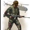
The picture below shows some of the military vehicles you can expect to see in the Rhodesia Bush Wars. Where this map is based in Rhodesia the base is not permanent and is more a staging area for the firefight expected in the area. You can see the HQ is a camouflaged caravan in the picture below as well as a few army tents....... these tents have already being modeled for the the mod. The Rhodesian forces will have Ferret Scout Cars housing a 7.62mm Browning machine-gun and the GM-powered Eland Armoured Car The terrorists were equipped with 122mm rocket launchers, 75mm recoilless rifles and 82mm mortars as well as TM46 anti-tank mine. Before 1979 the Rhodesian Army had not possessed any tanks and they recieved T-55 tanks from south Africa in October 1979 as a results of reports that terrorists under the command of Robert Mugabe were amassing T-34 and T-54 tanks in neighboring Mozambique where Mugabe was based. Due to how late in the war these tanks appeared, the T-34, T-54 and Rhodesia's T-55 will not be seen in this first map but will appear in my next map as an alternate timeline. In real life the T-55s were never deployed in the battlefield as the Lancaster House Agreement was signed just 2 months later leading to the end of the war. However the Rhodesians have the Eland Armoured Car which has enough firepower to get the job done against the enemy. -
[WIP] Rhodesia Bush War
RhodesianScout replied to RhodesianScout's topic in ARMA 3 - ADDONS & MODS: DISCUSSION
Operation Cheetah - In development A high value target is in the area and his capture is essential to uncover the location of two individuals whose capture could win the bush war overnight. -
[WIP] Rhodesia Bush War
RhodesianScout replied to RhodesianScout's topic in ARMA 3 - ADDONS & MODS: DISCUSSION
When it comes to navigating in the Rhodesia Bush Wars you will be limited to using tools like a compass and a paper map...... none of the state of the art technology used today such as lasers, GPS devices or drones. Early work on paper map. -
[WIP] Rhodesia Bush War
RhodesianScout replied to RhodesianScout's topic in ARMA 3 - ADDONS & MODS: DISCUSSION
There had been a change to the map I had not mentioned before...... previously I had stated that this was based at the Maleme Dam however some weeks ago this was changed to a dam with a lot better scenery for this map. This map is now based at a dam called the Mpopoma Dam... I think it is pronounced M-pope-ma........ I used to travel to this dam first on the western edges of Matopas and then head to Maleme further east. Mpopoma Dam is shown in the picture below and is one place you do not want to swim in as it is home to between 200 and 300 crocodiles......... I also updated my signature to the new map name Battle of the Mpopoma Dam -
[WIP] Rhodesia Bush War
RhodesianScout replied to RhodesianScout's topic in ARMA 3 - ADDONS & MODS: DISCUSSION
Yesterday I created 4 completely new textures for the map to cover the areas with two types of dry grass, sand or granite rock. Also created the normal maps for each of the textures and then tested them in the map.
