

Nicholas Bell
-
Content Count
396 -
Joined
-
Last visited
-
Medals
Posts posted by Nicholas Bell
-
-
-
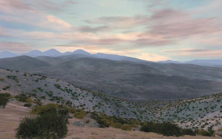
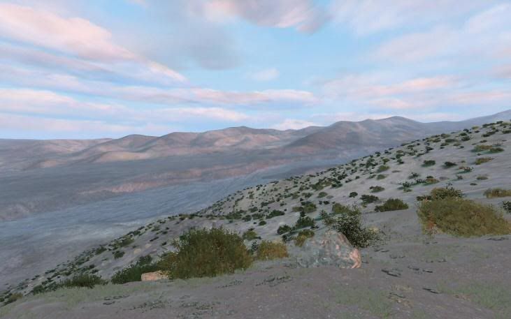
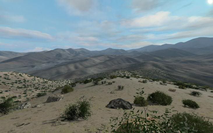
A 10 km x 10 km map featuring a potential real world hotspot - a haven for the Taliban and Al-Queda. Â Google Earth or Google Map Razani, Pakistan to get look at the area.
Map sports one of the few paved roads in the FATA and is fairly heavily inhabited with locals living in high-walled compounds called Kots. Â These are often situated on hills and ridges, each a small fortress. Â I am not a modeler so unless Opteryx or BadBenson are willing to permit use of their structures, I will simply use the standard structures.
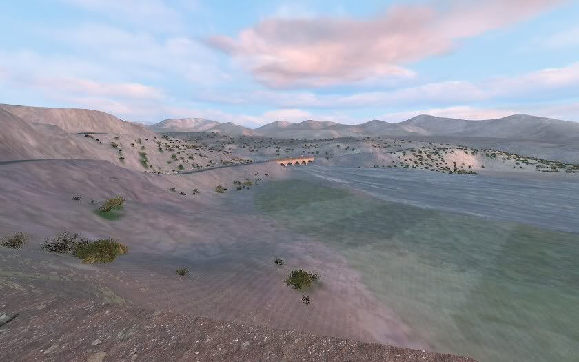
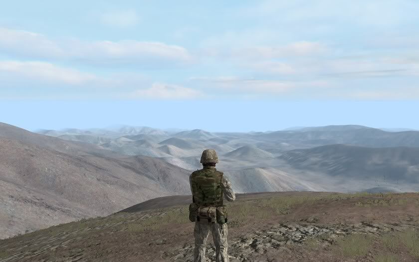
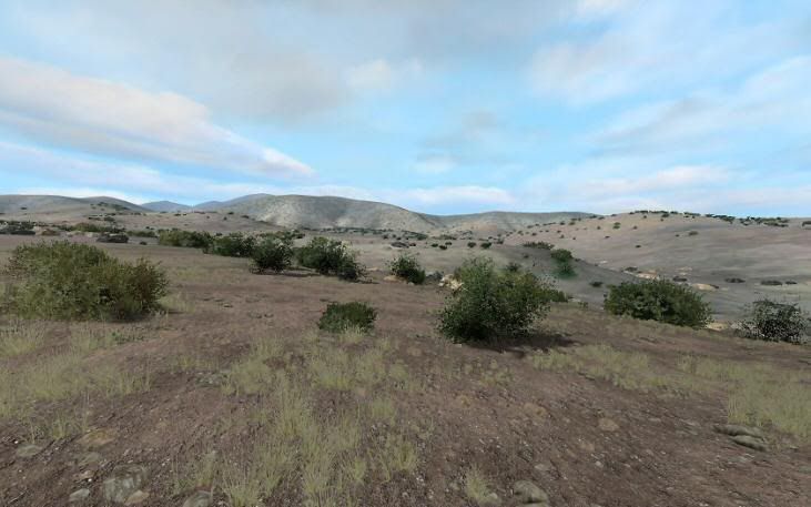
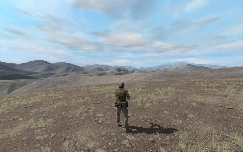
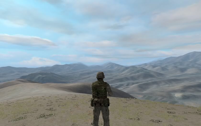
Terrain is very mixed, with mountains, hills, plateaus, wide dry river beds, gullies and ravines.
-
No luck with binarizing - the stutter is still there. Very noticeable while flying. Every couple of seconds. The log file is clean - no problems.
Guess I will spend the time I was hoping to save and drop back to a 512 pixel segment and see what happens.
-
Only in game with this map. I don't even have problems with my own Schmalfelden XHV.
-
It might take until next spring to finish it - just in time to update everything to ArmA2 standards Â

Satmap is also 10240,x10240. Â Satellite Grid is 24. Texture Size is 20 x 20 meters - it won't validate with the normal 40x40 meters.
It's a big, complicated map - I'm not surprised there is a performance hit. Â But I was expecting it until I started adding objects.
Dropping back to 512 pixel segment isn't life and death. Â I am attempting to get the texture color to match the satellite image color better - thus the need to have multiple textures. Â ArmA2 will handle this for me as I understand it will "pick up" the color of the satellite and apply it to the texture to some extent. Â It's all very pretty now - I just hate to have to give up the variations.
I may need to "borrow" your wheat with your permission. Â It will look great on Schmalfelden. Â
-
Recently revised a 10 x 10 km map from 512 pixel segments to 256 pixel and I'm getting "stutters" - normally not an issue with my system. Â I want to increase the number of textures I can squeeze in small areas.
Was wondering if anyone has any experience or comments on whether the segment resizing is the problem. Â I don't have any objects on the map when this happens so I know that is not the issue. Â Nor does dropping the visibility range make a difference.
Hoping someone can save me a little time attempting to isolate the problem. Working with a map this size is a real time-killer in V3.
Thanks!
-
Nice T-55, Rygugu. A more representative vehicle for 3rd World type conflicts - it will be greatly appreciated.
-
Wow! This gets better all the time. Apart from all the "big" things you have done, I especially like the wounded guys writhing in pain. Small but realistic touch.
-
Try Desert2.
Kind of ironic we are both working on maps of almost the same area, although I'm across the border in Pakistan.
-
Quote[/b] ]Firstly there's a simplistic and user friendly GUI, second it runs better algorithms and third you have some very nice slide bars which you can tweaking your normal/occlusion/specular/displacement/diffuse maps to greater detail than in Nvidia's plugin. Also you can view your textures in real-time 3d. Generally it's just a better app.Yep, I can see how right you are - thanks!
-
Quote[/b] ]When I import the layers on the Island I have no layers folder in my Data folder, so there are no layers on the Island...can you tell me please how to import layers with the new Visitor version?Check your Tools | Project Preferences to make sure your folder - textures is correct. Â You may want to check your P: drive to locate the missing files. Â I've made this error a few time myself Â

-
Any particular reason you recommend this, Opteryx? Since I know so little about this, I'm sure I wouldn't know the reason looking at output of either. I bow to your experience.
-
You got me thinking and found the answer - and it works:
The plug-in for PS is here, thanks to Kegetys:
Linker Split did a tutorial on making normal maps:
http://www.ofpec.com/ed_depo....cat=xyz
Knowing the proper terminology for the file type was the info I needed.
-
Well, I would appreciate knowing how you do it, although I sense you are angry about the lack of response and may not want to. Â I didn't respond because I don't have a clue. Â All I've ever done myself is adjust the color of the detail_co.paa files and renamed stuff. Â But any insight as to how one creates a new nohq.paa file would be a tremendous help to me.
-
"Wilbur" has a decent selection of good erosion routines which you can run on your heightmap.
http://www.ridgenet.net/~jslayton/software.html
I've never been able to figure out good settings for the V3 erosion routines either. Â It's always all or nothing, ie flatten the terrain way too much or I see nothing at all. Â I'm sure it works great for those who programmed it, I just wish they would have shared some of the many secrets of V3 with us.
Quote[/b] ]It's the DEM data, it's got steps in it.Wilbur also has a function which nicely fixes the DEM stepping. Check out the "Filter | Fill | Deterrace" function.
-
I understand your point and what you want, however, this leaves you with only the BIS maps. Â While creating enormous maps is technically possible, actually doing it is another matter. Â If one looks through the Addon Discussion and the Visitor folder there are many announcements of huge new islands under construction, some with early construction images. Â Yet the number of islands/maps released is few and their size is small or moderate. Â This is the unfortunate reality. Â It's still better than nothing at all. Â
-
Quote[/b] ]I just hope Nicholas Bell comes back with a map just as realistic and same terrain but in the form of an island,Sorry to disappoint, but it will be another map. Â I do have 2 real islands roughed out too but with Uhao's release it seemed a bit redundant. Â On the plus side it is larger than Schmalfelden - 10 x 10 km. Â Real terrain, and relevant. Â More details to follow.
-
Beautiful map, Opteryx. You never cease to amaze (and inspire) me with your work. Thanks!
-
Hah, I've had this problem too and like the rest of you I can't remember what I did to fix it!

-
Blackknight63-
Remember the source files for Schmalfelden are available:
http://www.sendspace.com/file/ajnv6m
Not only can you get some ideas and learn about the variables involved in placing objects and other things, you can cut and paste anything you think might be useful on your map if that makes it easier. Be sure to import templates to get the objects in your .pew file first. After that you could, for example, copy a block of woods, paste it on your map and then trim it down to fit the area on your map. No need to recreate the wheel, so to speak.
Good luck!
-
Quote[/b] ] The only thing we can do with ArmA is use small segment sizes. I seem to remember starting to test the performance impact, but can't remember the result.I changed the segment size in Schmalfelden around v.94 from 512 to 256 pixels and didn't see changes in the frame rate. Loading time may be a bit longer because of the additional files.
Quote[/b] ]If i just know how to set the grid (sizes between squares) i would set a new layer to my PS mask and would guide my colors through it, minimizing the color problem.Bravo 6-
I found the easiest way to figure this out is to open the chopped up .png files in the Layers folder. Overlaying adjacent "s" files allows you to determine the amount of overlap. The exact formula is in the Biki but the translation to English there makes it difficult to understand. Thus my workaround.
-
For placenames, there is supposed to be a way to put an "include" command in cpp file which reads the hpp file. I couldn't figure it out, so simply included the names in the cpp file directly. Please see the Schmalfelden source files: http://www.sendspace.com/file/ajnv6m
The road type Silnice that comes with the Visitor install is not usable. I have not the slightest clue on how to fix that, but others with knowledge of Oxygen and modeling might be able to help you one that by using the BIS release of all the model data some time back.
-
Quote[/b] ]What happens if more then 4 colors are in same square, what are the in game symptomsTwo possible results:
If the extra color is close to another "good" color it will display the "good" color. This can be hard to spot, which is why creating a satellite image from your mask image can be useful. I had white, yellow, red, green and blue in a segment and the program decided that the white was yellow (the predominant color).
More typically, the segment with more than 4 colors will be pure white.
-
Excellent. These will be useful in future map/island projects.
Razani, North Waziristan Map
in ARMA - ADDONS & MODS: DISCUSSION
Posted
This is the unedited raw STRM DEM data as viewed in Leveler, a heightmap editor. Â This is not an accurate representation of the terrain - the 90 meter grid misses too much data.
Here is the current edited heightmap I have created which still is not rough enough in many places.